Voted by ITV viewers as one of ‘Britain’s Favourite Walks’, the Sandstone Trail stretches for 34 miles (55km) across Cheshire’s Sandstone Ridge (or Mid-Cheshire Ridge), from Frodsham by the Mersey estuary to the northern Shropshire town of Whitchurch. After years of seeing ‘Sandstone Trail’ signs at Delamere Forest, Beeston Castle, Bickerton Hill etc, I finally decided to walk North-West England’s most popular middle-distance trail.
We planned to complete the trail over two days, with a stopover wild camp at Bulkeley Hill around the 20 mile mark (33km). This meant we could complete the majority of the harder parts of the walk on the first day, and finish with the softer countryside section on Day 2, when our bones and muscles would likely be sore.
In preparation I bought this:
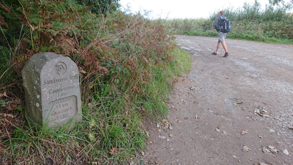
It was a GODSEND. The best thing about a paper map is that it doesn’t run out of battery. The Sandstone Trail is very well signposted, but there are a couple of places on the walk where this map really helped out in keeping us directly on track. It is £8.49 absolutely well spent.
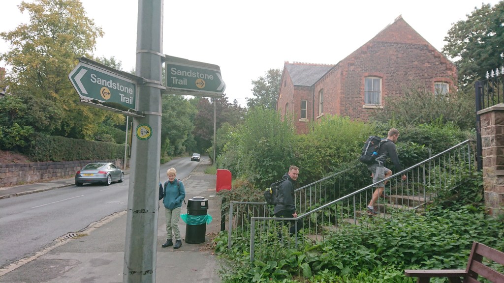
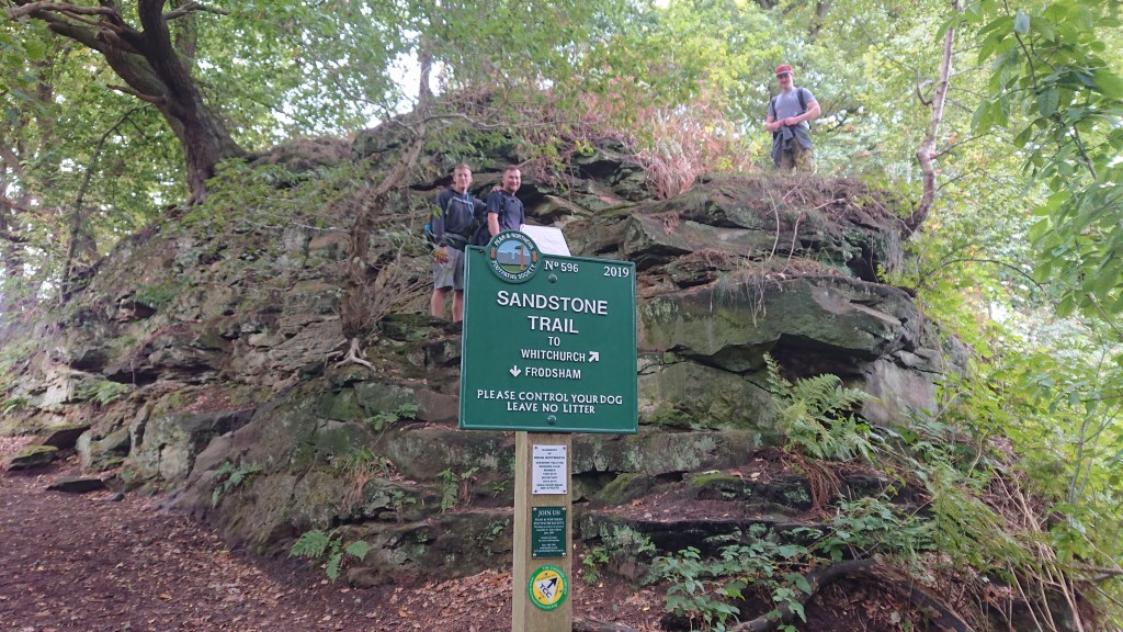
On a cool, grey September Sunday morning, we arrived in Frodsham. I bought some paracetamol from Sainsbury’s whilst Jack and Sean did a last minute poo in Subway.
Bags strapped, coats zipped and bottoms wiped, we walked down to the starting point.
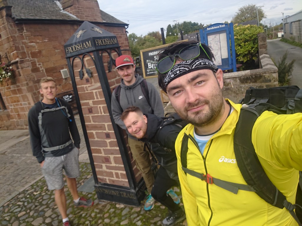
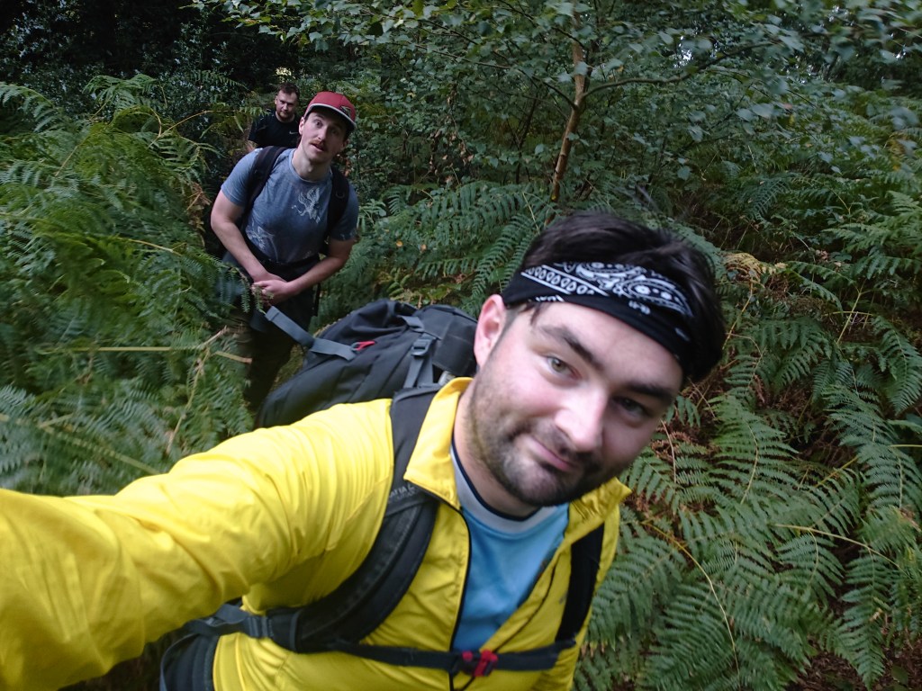
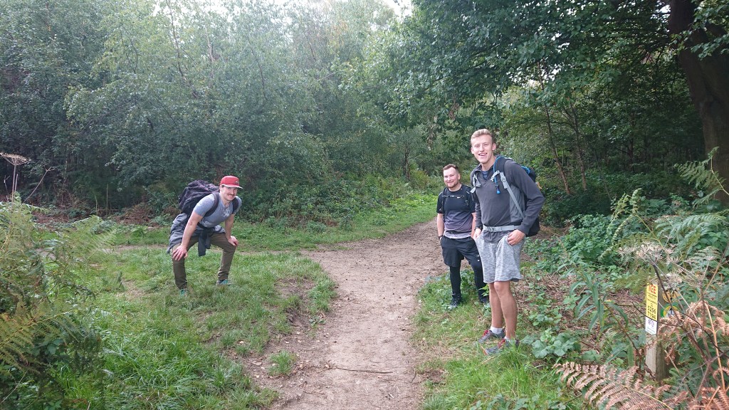
Joining me on the adventure was Jack, Tim and Sean.
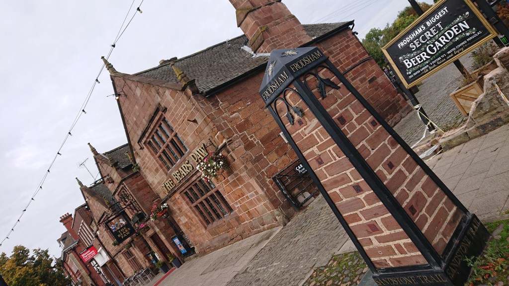
Immediately I regretted not starting in Whitchurch and ending in Frodsham, cos The Bear’s Paw looks like the perfect pub to have a celebratory post-ramble pint in.
Ahh well. Whitchurch has a McDonalds…
At 10:06am, Sunday 25/09/2022, we began our journey.
DAY 1
Frodsham to Manley Common
Only a minute into our expedition and we had to face our first perilous obstacle – a quiet Sunday morning road.
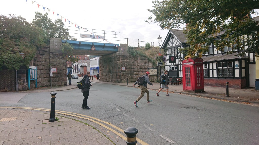
We safely made it to the telephone box.
What an unassuming telephone kiosk you may think, but oh no, this is a special telephone kiosk, as telephone kiosk go.
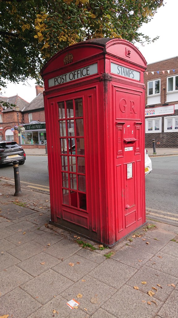
It’s also a post box, and it used to be a stamp dispenser too. This “Vermillion Giant” circa 1927 is one of only 50 made and one of only 4 to still stand.
Simply awed by this history lesson, we pressed on up the hill (back passed the Sainsbury’s we’d just come from) until our first signpost of the day directed us away from the road.
We navigated our way through the residential streets and arrived at Frodsham Hill.
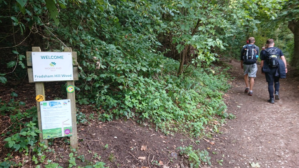
It was our first taste of an incline and we had to get used to it. However, the hill is only 152 metres high so we up in just 6 minutes.
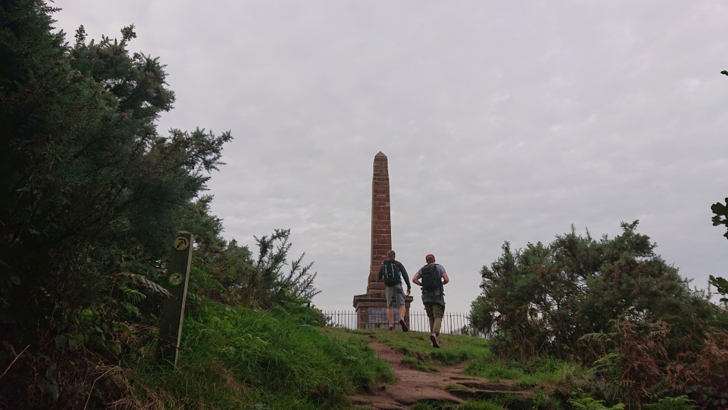
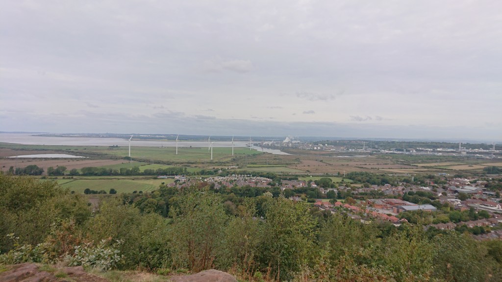
At the summit stands the Frodsham War Memorial, commemorating the local men who died in the Great War. It’s an impressive obelisk set against great views of the Mersey estuary, the Frodsham wind farm and Liverpool in the distance.
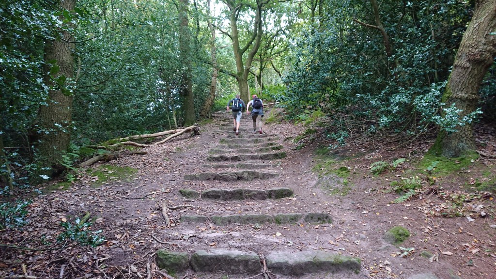
On the other side of the summit, the path descends back down into the trees and reveals the first bare sandstone rocks on the trail.
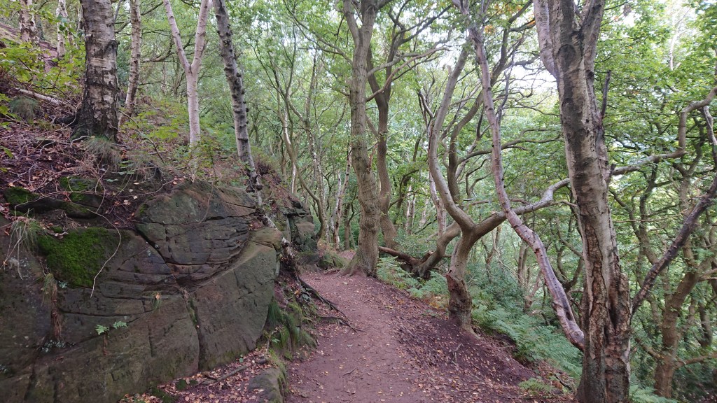
This is why we’re here! To marvel at stone!
As I said, the Sandstone Trail is very well signposted. However there is a point on Frodsham Hill where the arrows point left when really you should go right. There is a former golf course that the arrows now confusingly direct you over – but the trail was built to skirt around the course. We went left and only with the help of some locals did we manage to find our way back to the trail. We should have stuck to the map and gone right. If you’re ever in real doubt, Google Maps has the Sandstone Trail marked as a route so you can use that too – a couple walked the majority of the route in 2018 and used a street-view camera to plot it onto Google Maps – thank you Jim Gayes!
Soon we were climbing again as we hiked up Woodhouse Hill. Again, the ascent was straightforward and not difficult. On my OS map, viewpoints are marked, which gives you something to look forward to and also helps you see where exactly you are.
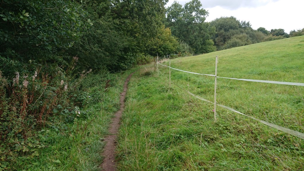
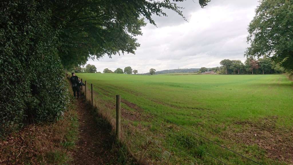
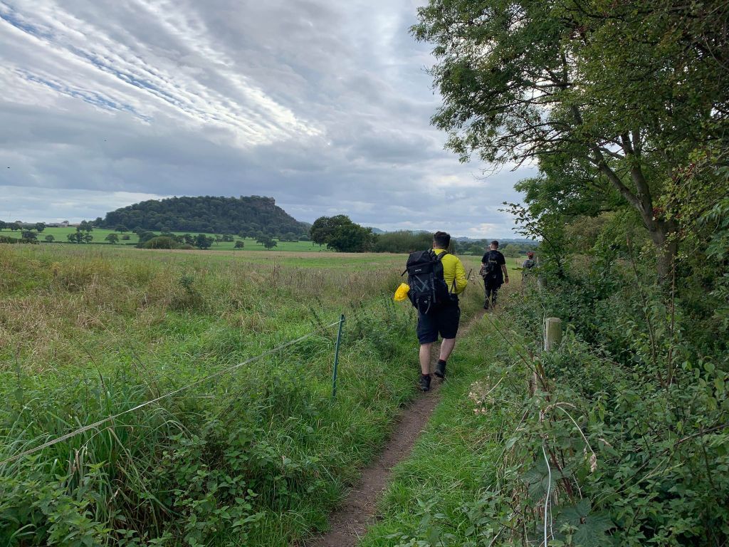
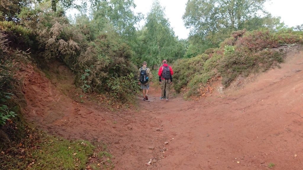
After descending Woodhouse Hill, you notice the landscape change. Gone are the vistas of towns and urban life, replaced by countryside.
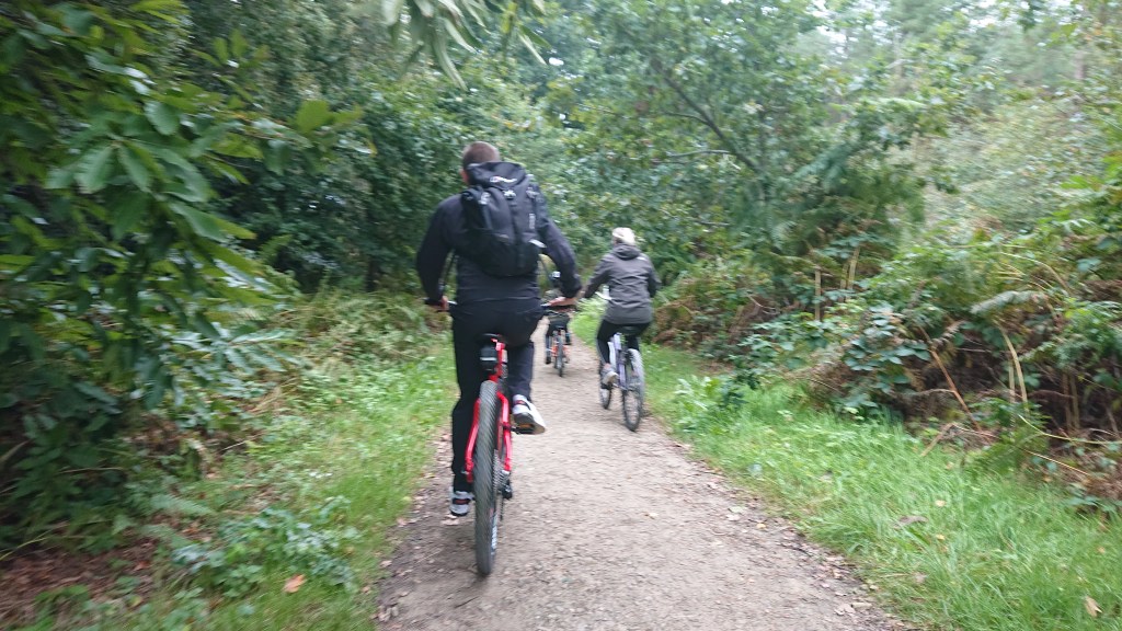
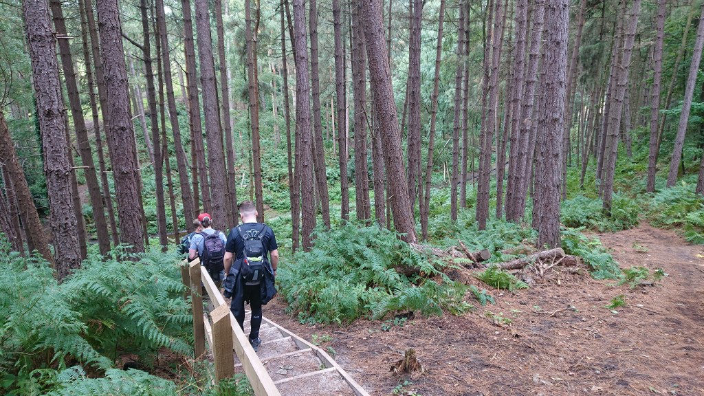
The path narrows and becomes a rural trail, featuring ferns…
Electric fences…
And a group of elderly ramblers.
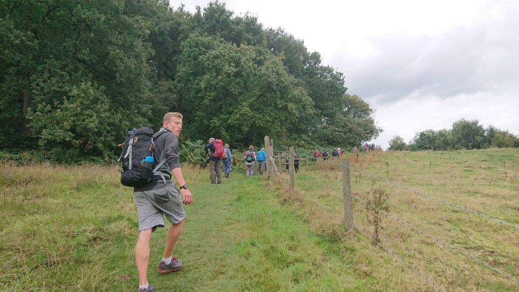
It was a little awkward having to overtake around 30 men and women, apologising and thanking each and every one. It was even more awkward when each and every one re-overtook us when Sean realised he’d lost his expensive sunglasses.
Jack (who is so full of energy it makes me sick) ran back to try and find them, but we soon realised after looking at my photos, that the glasses had been gone for some time. Sean had clipped them onto his bag and not zipped them in a pocket for some reason. A lesson learned, I’m sure.
Mourning our first loss, we pressed on and quickly re-caught the ramblers, who we overtook again with yet more thanks. Tbf they were lovely and wished us luck on our big walk.
As we neared the village of Manley, another hazard made its first appearance.

Nettles. For me and Jack in our shorts, these parts of the trail were often marked by cries of pain.
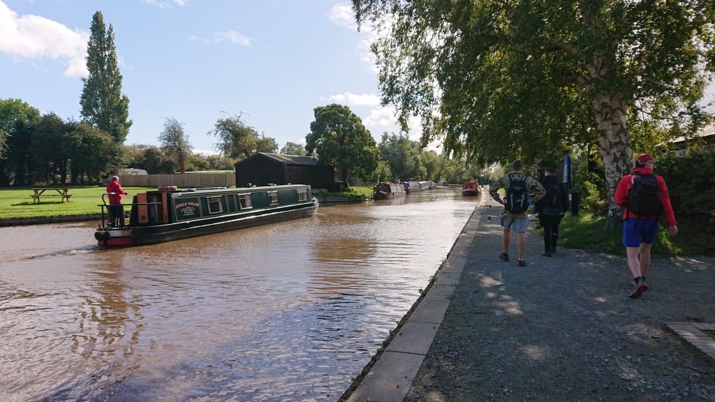
At Manley, the trail joins the B5393 and passes by the village.
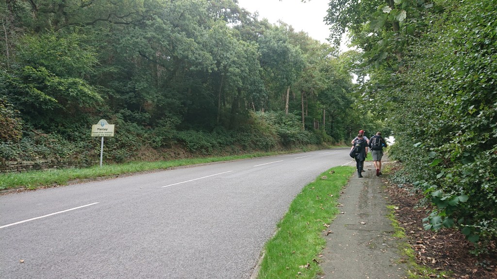
Thankfully, this is the only part of the entire trail where you’re just walking alongside a main road. Soon, a gate appears on the eastern side of the road and the Sandstone Trail arrows direct you through it across Manley Common, with Delamere Forest and Old Pale Hill in the distance.
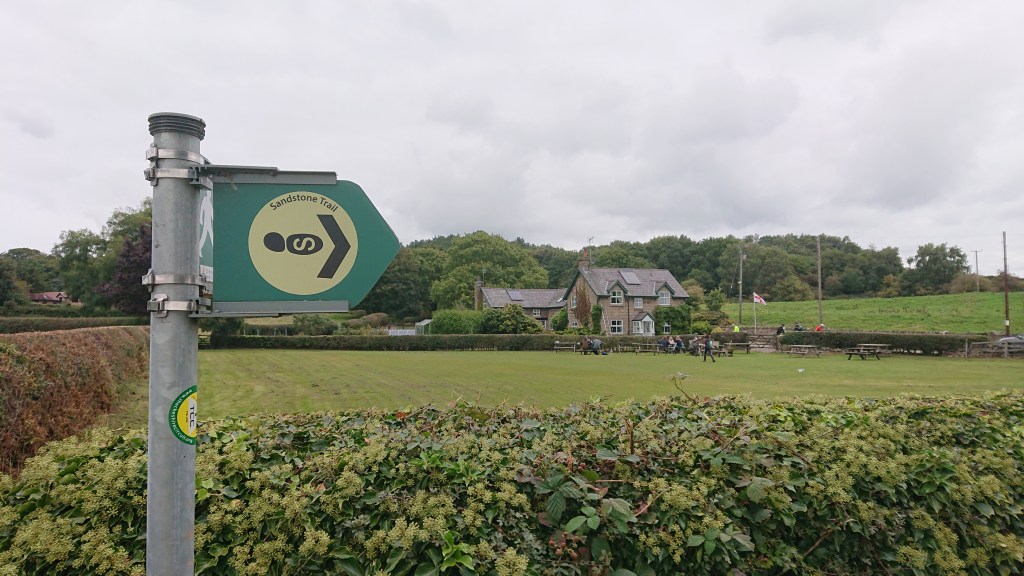
Here is the first proper rest spot on the trail, Stonehouse Farm B&B with a cafe serving hot food and drinks. However, cos we’re so young and virile, we powered on through.
At 12:24pm we arrived in Delamere Forest.
Delamere Forest
A place I know so well, but I’ve never entered from this direction before.
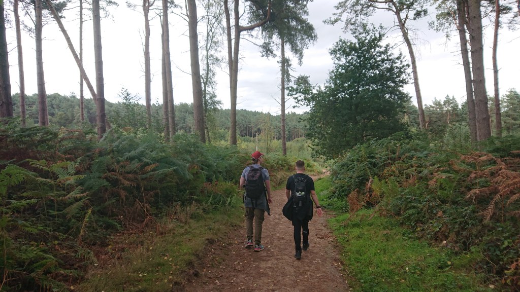
Being so close to Chester, Merseyside and to an extent, Manchester, Delamere is always, always busy on a weekend. It’s much nicer to visit in the week when you have the place mostly to yourself.
Alas, it was a Sunday, so typically we got stuck behind people. I didn’t expect those people to be on bikes though.
The kid did not want to cycle today.
Despite the crowds, it is a lovely place to walk with enveloping canopies and Jurassic-looking meres.
Just don’t be a prick and take your rubbish with you.
Where did they think they were? Costa? Did they think some spotty waiter was gonna pop out from behind a bush to clear away their shit? In David’s Britain, such a crime would be punished with locking perpetrators in their homes without bins, see they how they like living with their own rubbish.
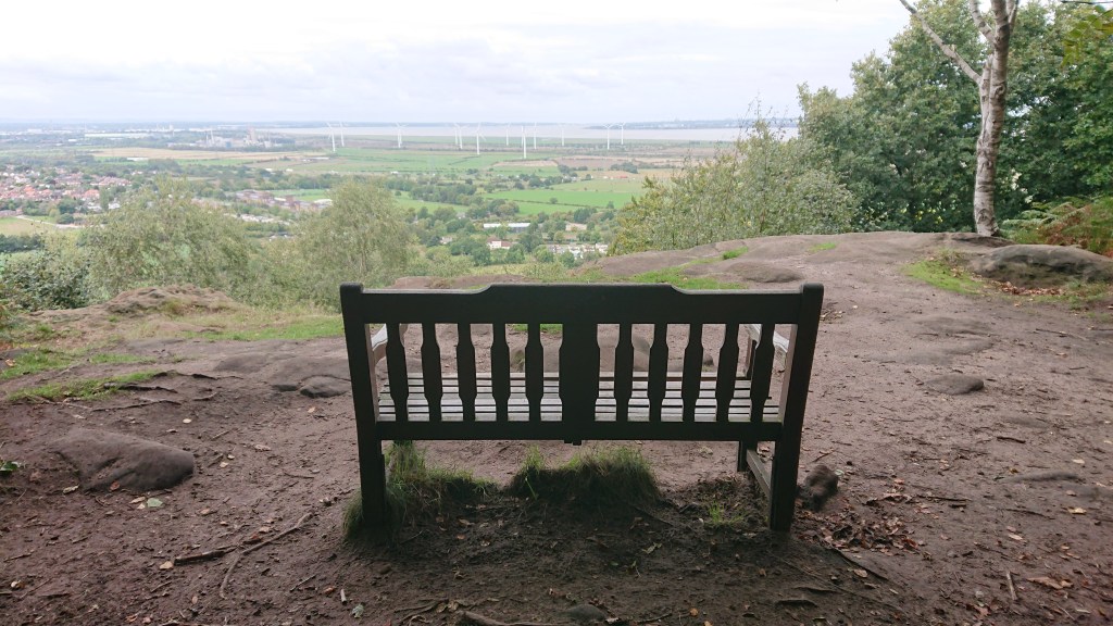
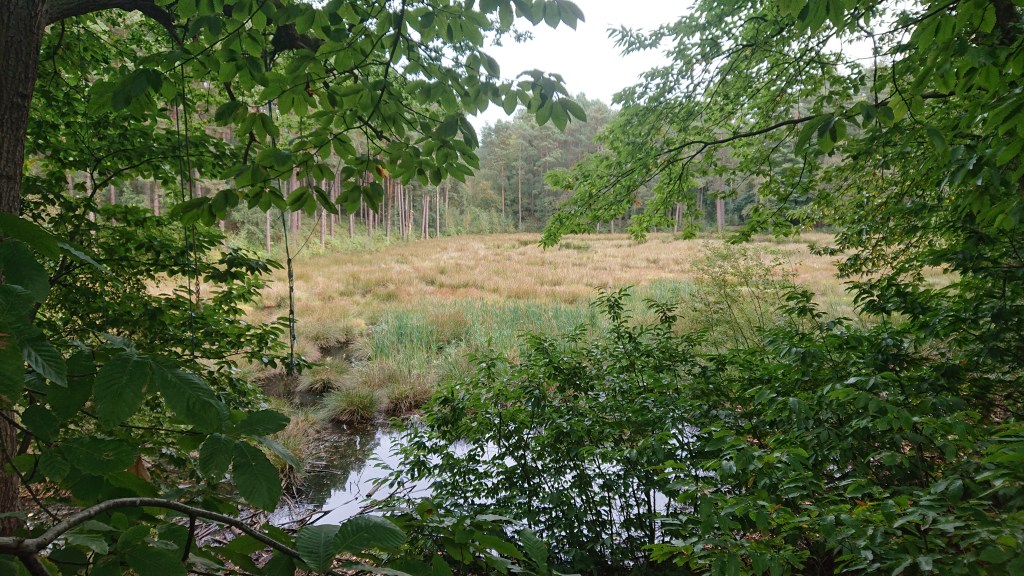
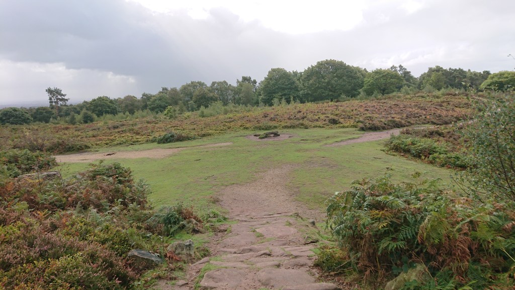
Soon we left the more popular parts of the forest and headed towards Old Pale Hill.
It’s a slight detour from the Trail, but it’s worth it, especially on a clear day when you can look out at Manchester, the Pennines, Wales etc.

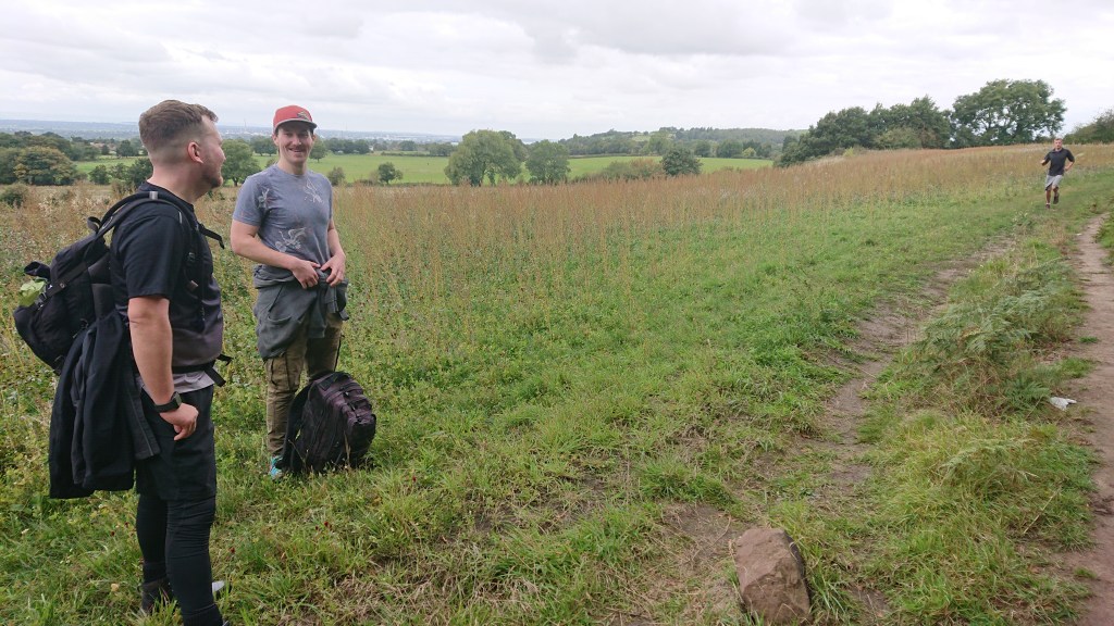
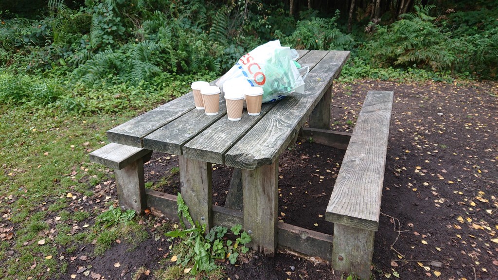
After a quick 15 minute break for sweets and sandwiches, we returned to the trail and headed towards Gresty’s Waste, crossing the very busy A54 on the way. Much caution is needed at this crossing!
Gresty’s Waste to Beeston
Gresty’s Waste is a cute little wooded valley that looks and smells beautiful in the autumn especially. An ex of mine once cheated on me here with my former best mate, so the feelings I have for this place are mixed.
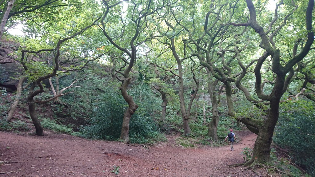
The Sandstone Trail takes you through Gresty’s Waste, up Primrose Hill and into Primrose Wood.
This section of the trail is just outside the village of Kelsall, where you can take a detour if you need to re-supply or have a pint.
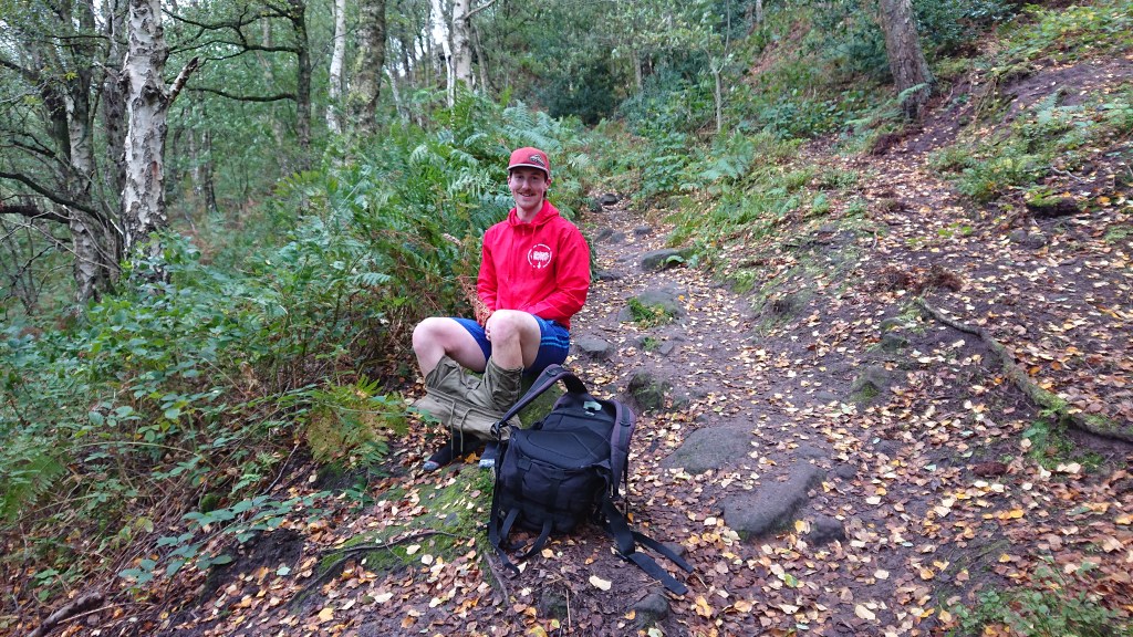
Primrose Wood also features Urchin’s Kitchen, a small rocky gorge formed in the last Ice Age. Unfortunately, we bypassed this site as we wanted to be at Bulkeley Hill before nightfall and still had a long way to go. Jack did find time though to have a swing.
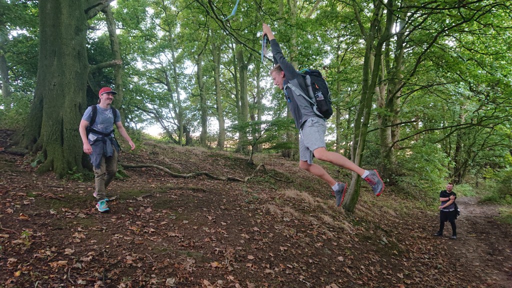
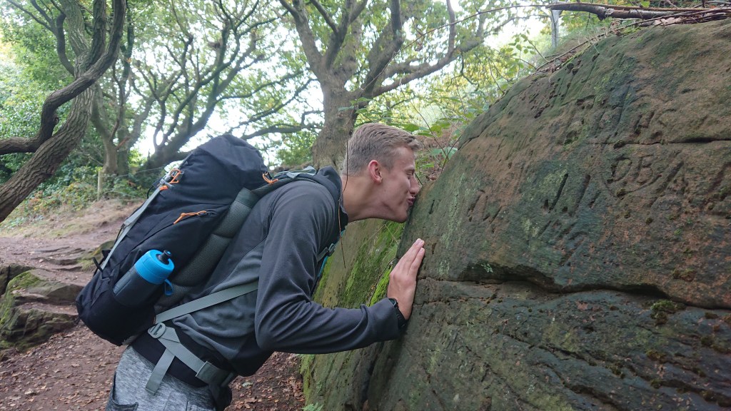
And find his new favourite tree.

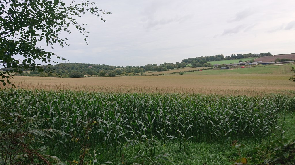
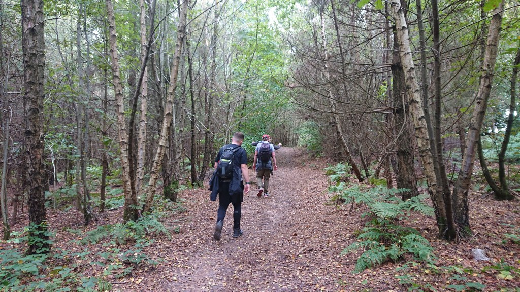
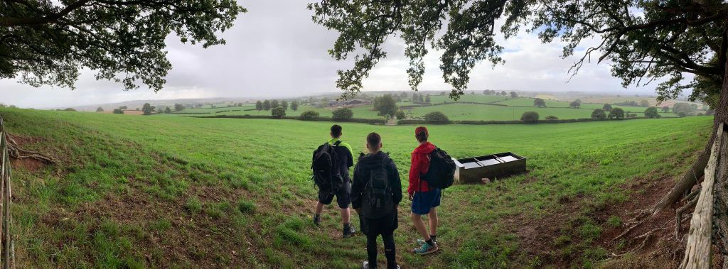
Soon, we left the final line of trees in Willington and entered the open farmland that separated us from Beeston.
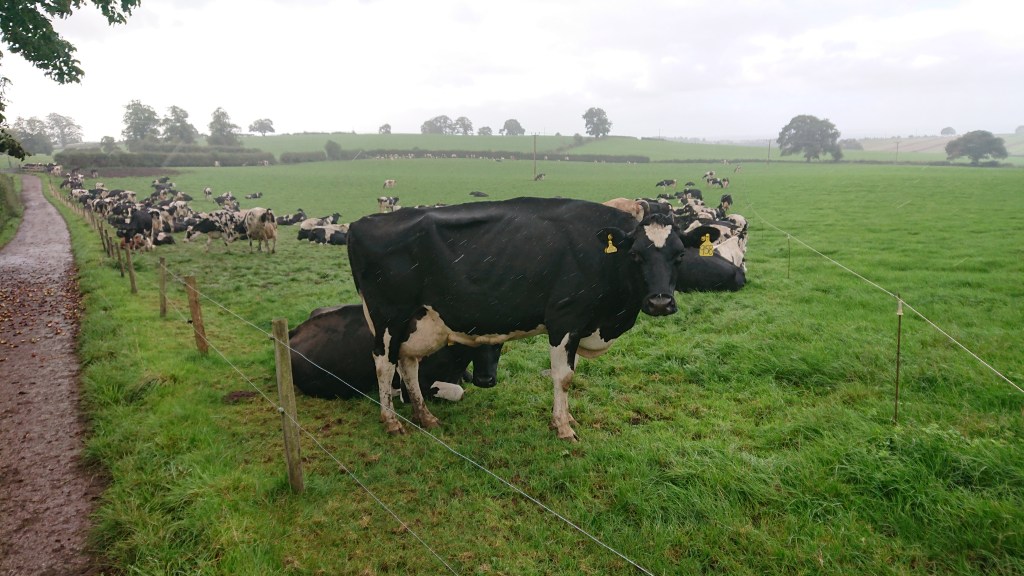
This section is rather featureless, but the peace is tranquillity is addictive. With the map and the signposts we, easily navigated our way through the fields. We met some cows…
Waved at a farmer…
And found some corn.

Sean hopes you have a corntastic day.
Whilst passing a field of cows, Jack informed us that if you shout “sex” at a herd, they get excited cos they think it’s time for milking. He then proceeded to shout “sex!” at them and they indeed followed us and even started mounting one another.
Is there actual truth in this?!
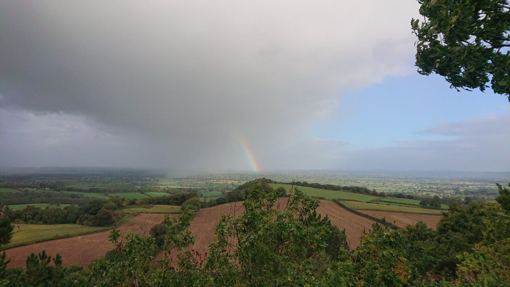
Meanwhile up above, the clouds teased us with some blue sky for the first time all day.
And this was the sunniest it got.
Finally… finally… Beeston Castle seemed to be within reach.
Before approaching the castle on the hill, we took a much needed second break at Wharton’s Lock.
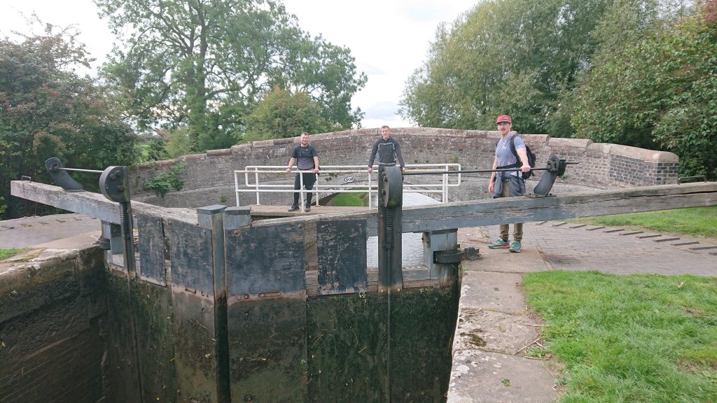
It’s safe to say that my legs were a little bit knackered. Sean shared in my pain, but annoyingly, Tim and Jack were apparently fine.
After a lovely 25 minute break spent listening to the running water of the lock and also having my first wee of the day (where I very nearly exposed myself in front of a young family before finding a more secluded bush), we continued across the fields towards Beeston.
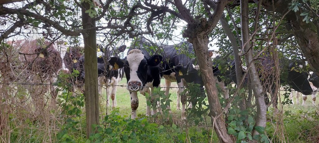
Between us and Beeston were yet more cows. This herd had decided to congregate at the next kissing gate, completely blocking our way.
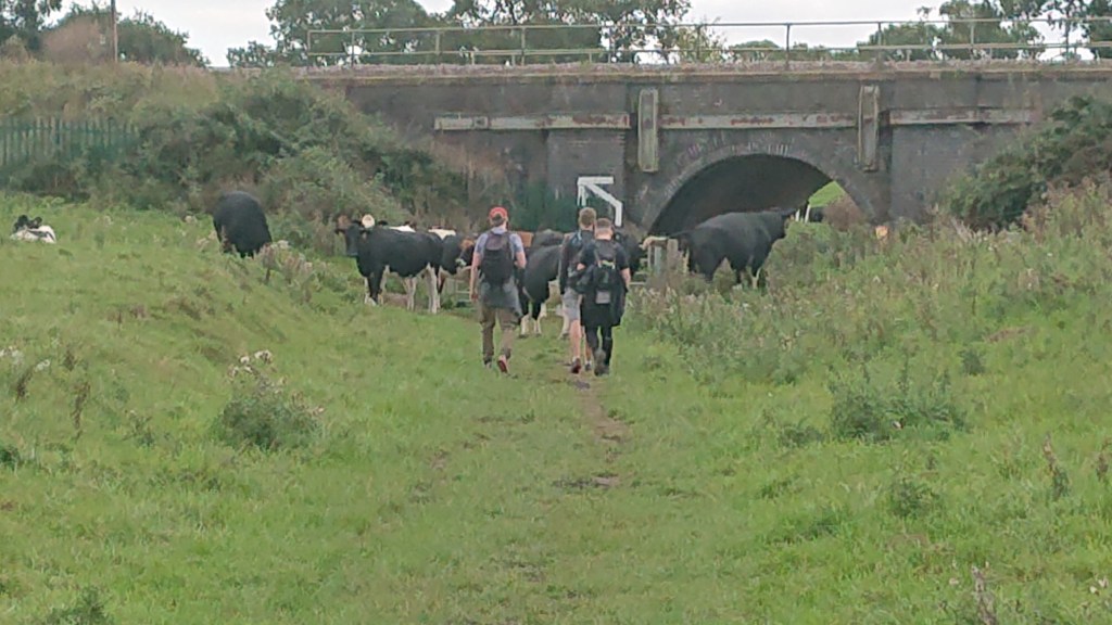
I don’t trust cows so I bravely hung back and let the other guys usher them out of the way.
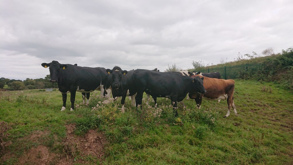
Thankfully, they didn’t trample us.
At 5:07pm, seven hours after starting our journey, we reached Beeston Castle.

Well, we reached the gatehouse. The castle had closed 5pm. Yaaaay…
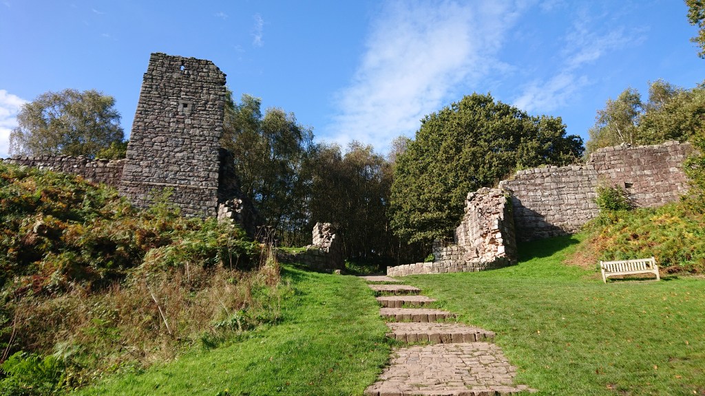
Tbf, we never planned on going inside. Despite Beeston Castle being the flagship landmark of the Sandstone Trail, the castle isn’t actually a part of the route – it’s a detour that will cost you £10 if you’re not a member of English Heritage. However, we were 7 minutes late for buying a bottle of mead at the visitor shop, which was truly saddening.
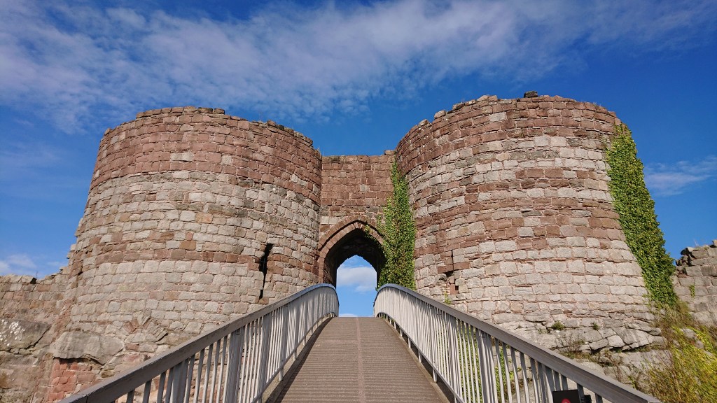
Anyway, I visited Beeston Castle a few years ago when I was a member of English Heritage, so here it is if you’re interested…
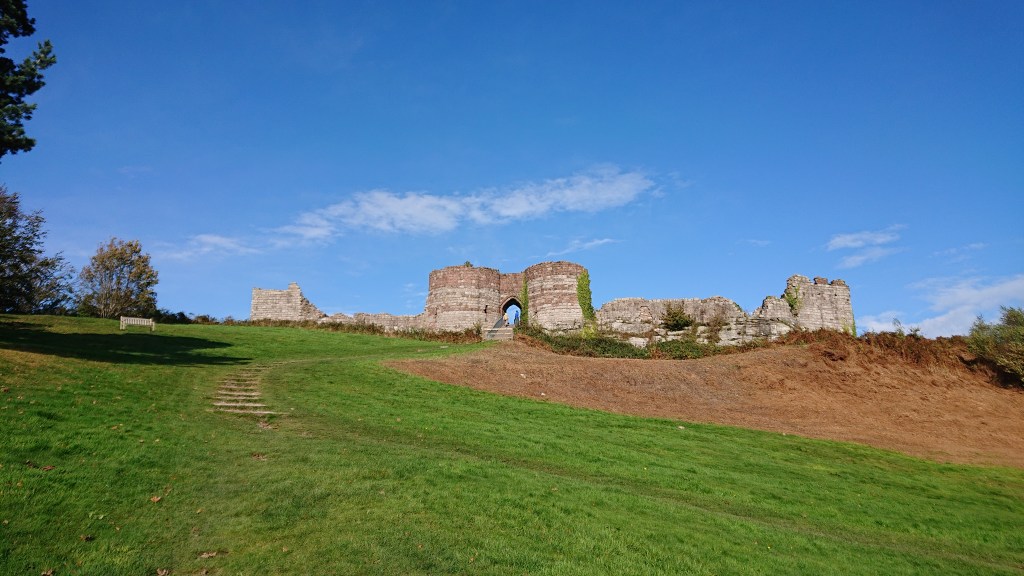
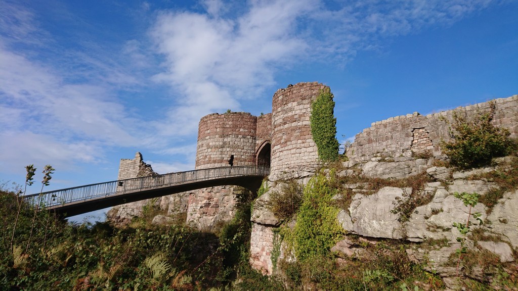

It is worth a visit and the views are great from the top. When I was a kid, we came up here and watched a thunderstorm to the west, striking the Cheshire plains with lightning bolts. That was impressive.
Beeston – Bulkeley Hill
Skirting around Beeston Castle, we headed across another field towards the Peckforton Hills, where neighbouring Peckforton Castle peeks out from behind the trees.
Whilst Beeston is a genuine 13th Century castle, Peckforton is a Victorian country house built to look medieval, and today acts as a hotel. It’s well posh, there. Their cheapest rooms are £305 a night. We decided not to book ourselves in.

The trail goes through the Peckforton estate, which is absolutely full of pheasants.

And I mean FULL. They were everywhere. We saw hundreds of them – no wonder the local pub in Burwardsley is called The Pheasant.
After some minor inclines through the trees, the path then climbs up onto the ridge – and at 5:40pm after over 7 and a half hours of rambling, this was pretty tough on the body.
Sean especially was fed up of hills by now – but we still had one more to come.
The path then descends into the Peckforton Gap, where you’ll see this pretty gatehouse.
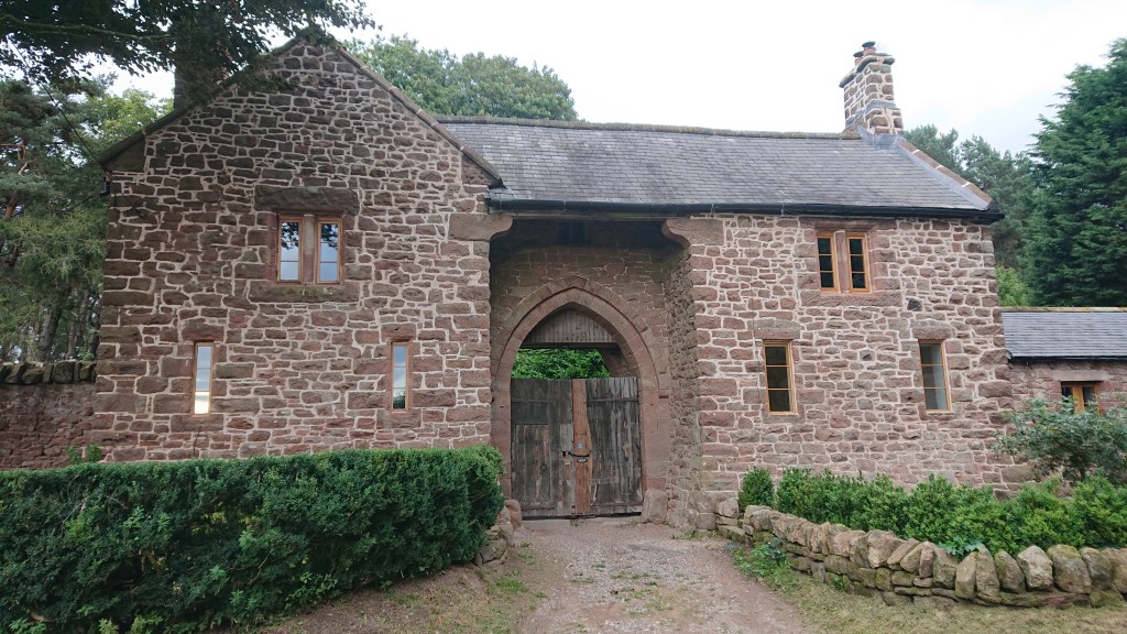
Not sure what it’s the gatehouse for though… Just trees by the looks of it.
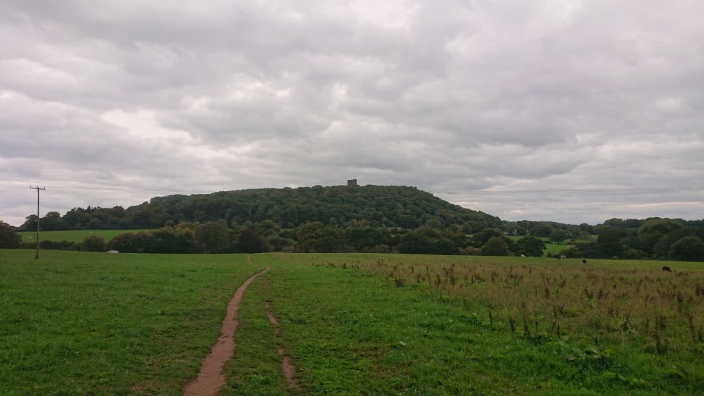
Opposite the gatehouse on the other side of the Peckforton Gap was the final climb of the day: Bulkeley Hill – or Bickerton Hill according to Sean – I had to explain many times that this was Bulkeley Hill and we would be climbing Bickerton Hill tomorrow.
Tim and Jack decided to run up it.
They had been doing this all day – showing off random spurts of energy. It made me and Sean sick. What a shame they didn’t trip and embarrass themselves.
At 6:17pm we made it to the top of Bulkeley Hill (Sean: “Bickerton Hill”) – our resting spot for the night.

It’s yet another lovely place to come and look out at the Cheshire plains. It’s famous locally for this old little train track that runs right to the top, called the Bulkeley Hill Narrow Gauge Railway.

Hey Sean, innit weird that this railway is called “Bulkeley Hill Narrow Gauge Railway” and not “Bickerton Hill Narrow Gauge Railway”?????
It’s 320m long and Cheshire’s steepest railway, though no longer in use. If you’re so inclined, you can walk it all the way to the top. I tried it once but when the girl I was with saw how the second half was even steeper than the first, she made us turn around. I don’t blame her tbf – it looks horrible from the top.
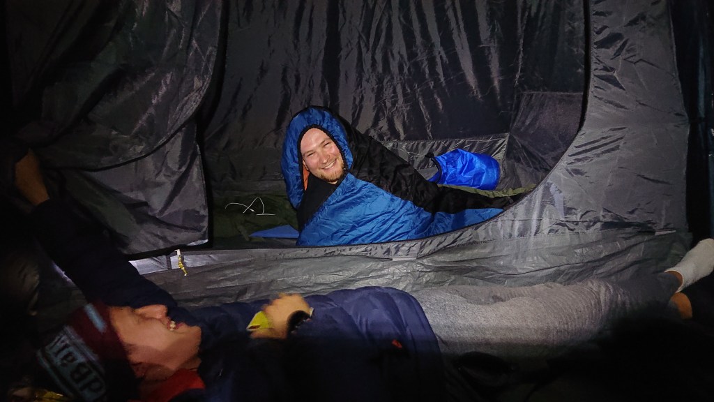
We climbed into the trees, up onto the actual summit of the hill, which is off trail, and found a clear spot to make camp.
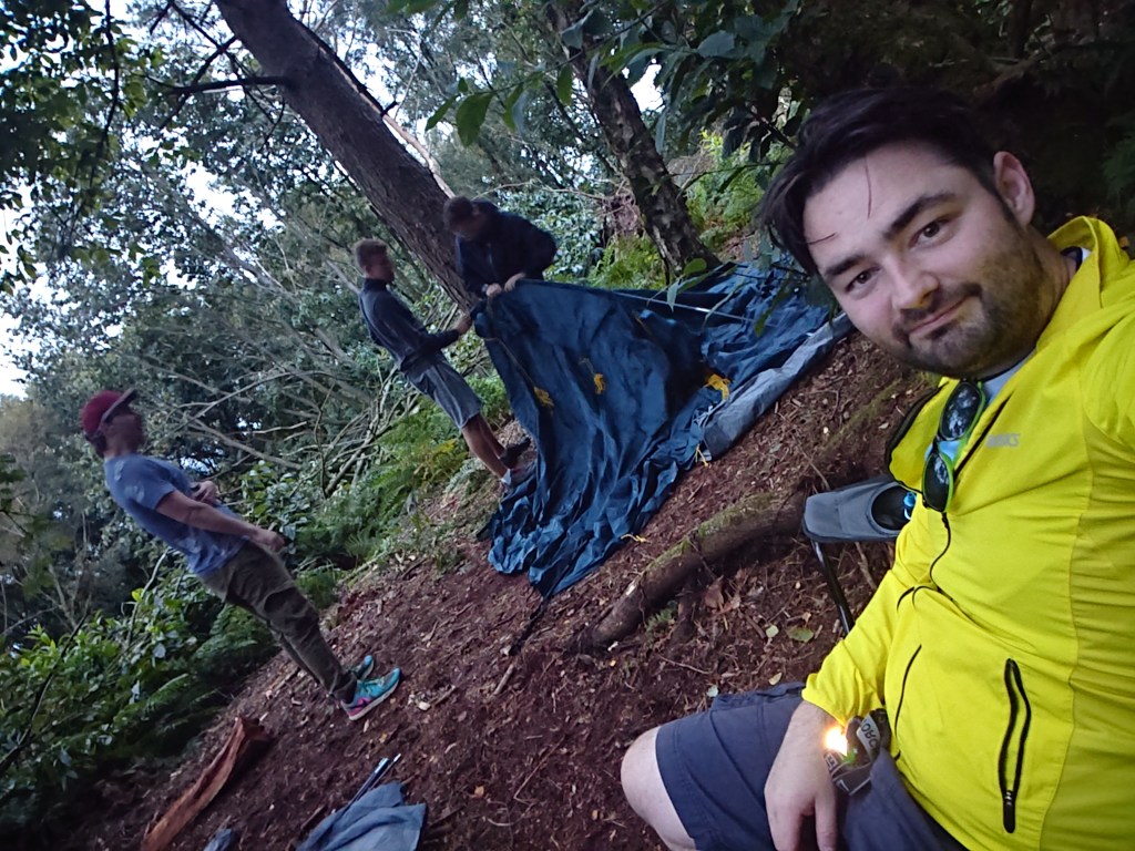
Well, I sat in my camping chair and let Sean and Jack do most of the work.
So, let me just point out that wild camping in England isn’t technically legal without the land owner’s permission. We chose to camp on Bulkeley Hill as it’s owned by the National Trust, not some local farmer who our presence may annoy. Wild camping in England is only tolerated so long as you leave absolutely no trace – so no campfires, no litter – and stay away from any homes. We made our camp up amongst the trees, away from the trail. We arrived late and left early the next morning. You’d never have known we were there – and that’s how it should be. Respect the land.
Here’s the massive 4-man tent we used.
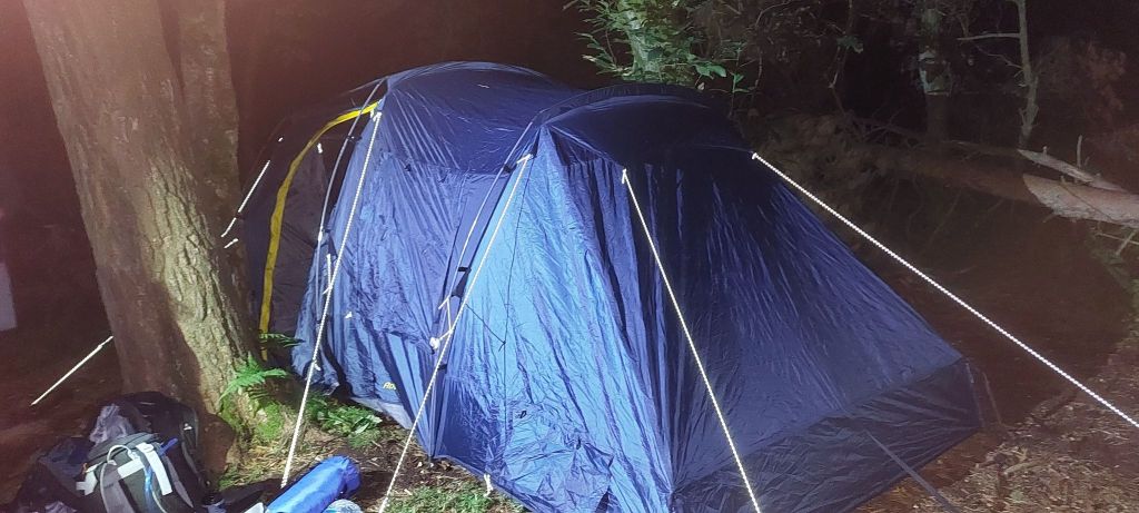
It weighed 13kg. In the days running up to our adventure, Sean had said he would be able to carry it the whole way. Now, after walking 33km and having a very broken body, he was glad he didn’t have to carry the tent as well.
Earlier in the day, I had parked my car at Bulkeley Hill, in which we stored the tent, extra water and sleeping bags. It’s probably not the authentic backpacker method, maybe it was cheating, but I don’t care. I call it good planning.
Having my car near the campsite also meant we could save our legs and drive down the road to The Bickerton Poacher for a well earned drink.
Sean: “So, why isn’t this called The Bulkeley Poacher??”
FFS Sean.
Good night from BULKELEY HILL!
DAY 2
Bulkeley Hill to Bickerton Hill
Good morning from Bulkeley Hill!
The weather in the night was windy, and Sean and Tim didn’t sleep well because of it. I wasn’t bothered by the wind, but the cold kept waking me up – and every time I pulled out another layer of clothing from my bag to drape myself in. My first ever wild camp, and I enjoyed it!
With tent packed away and stored in the car alongside bags of rubbish, we left Bulkeley Hill at 8:40am and headed towards Raw Head, with just 22km (13.6 miles) to Whitchurch.
The weather forecast for Monday had been pretty terrible; rain all day. And just 100m from the car, the heavens opened.

Ohhh this is gonna be a fun 13 miles.
Luckily it was just a passing shower, but we could see more on the horizon.
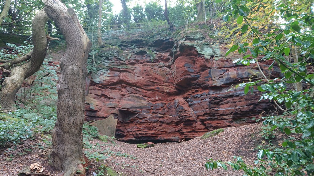
On the way to Raw Head, Jack directed Tim and I down the cliff-side to Mad Allen’s Hole (Sean’s decided he couldn’t be arsed).
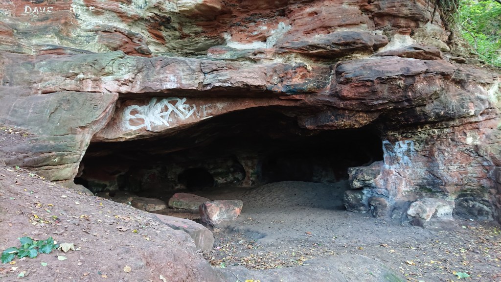
There are a few tales of different men who have made this cave system home. It stretches fairly far underground, and the amount of litter in there shows how it’s popular with locals who can’t be arsed to clean up after themselves.
Back on the trail we came to an observation point and saw another raincloud apparently coming for us.
Somehow it missed us. Luck was really on our side this morning – we seemed to be dodging all the rain.
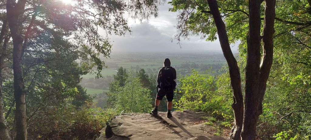
At 9:09am we reached Raw Head.
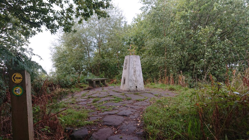
With an elevation of 227m, this is the highest point on the Sandstone Trail and the only peak with a cairn.
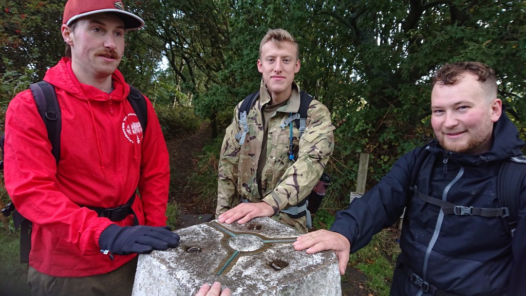
Bagged it!
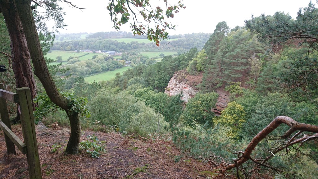
There are some great vantage points on Raw Head – when the weather isn’t so foreboding.

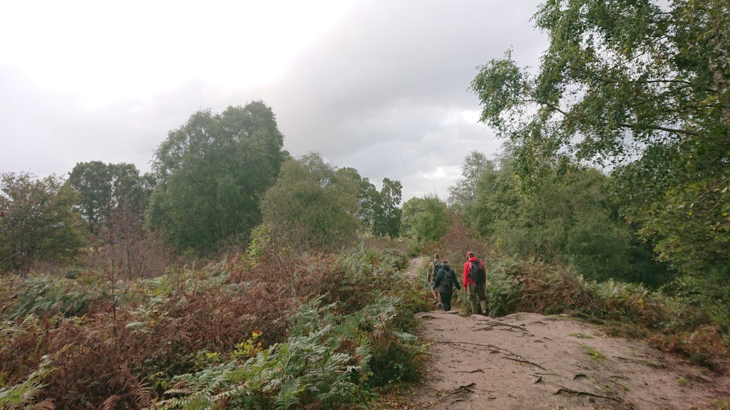
Onwards we pressed, off Raw Head and towards Bickerton.

Look Sean! BICKERTON HILL!!
This was the final climb of the entire walk and Sean was happy to hear this. Be aware that during the summer months you are likely to find a herd of massive cows grazing on Bickerton Hill. The other week, Aimee and I had visited Bickerton and a massive Highland bull just appeared from the bushes a few metres to our left. It was like being on safari, or in Jurassic Park.
The summit is a plateau with two high points – the first being the Kitty Stone.
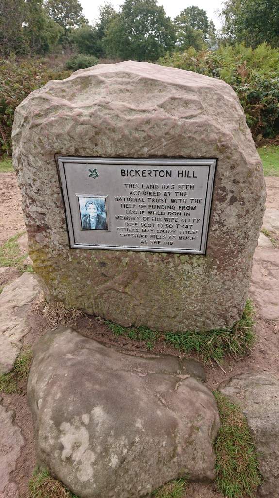
A memorial on the sign reads:
“This lands has been acquired by the National Trust with the help of funding from Leslie Wheeldon in memory of his wife Kitty (nee Scott) so that others may enjoy these Cheshire hills as much as she did.”
I want a memorial like that. Someone please acquire a hill in my name please.
We headed across the heath and over to the former site of Maiden Castle, an Iron Age hill fort probably occupied from 600BC until the Roman conquest in the 1st Century.
Not much remains, but you can make out ramparts underneath the heath.
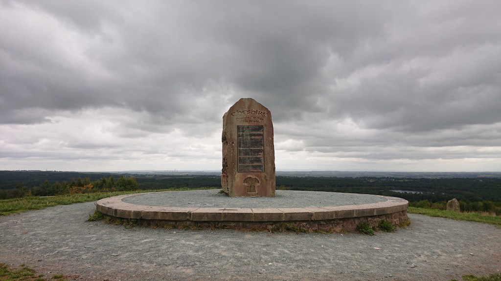
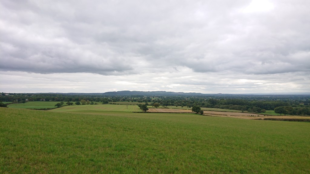
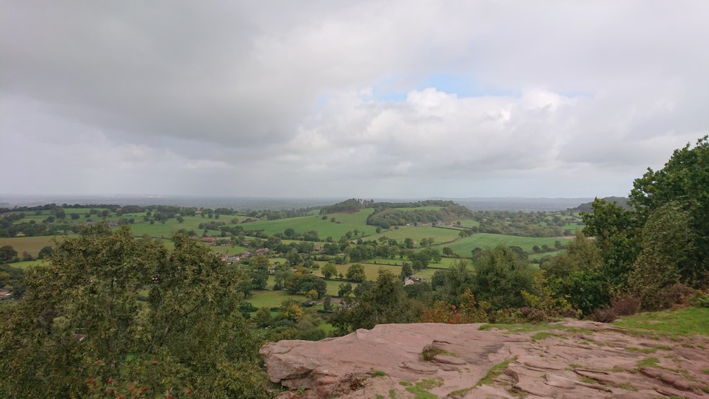
We took in our final hilltop view of the day. Btw, this westerly facing viewpoint is a great place to watch the sunset.
We headed back down into the woods. We had prepared for rainy weather but it was actually getting a little warm for some.
We descended around the wooded ridge on the south-west side of Bickerton Hill before the Trail signs directed us out into open countryside.
Bickerton to Willeymoor Lock Tavern
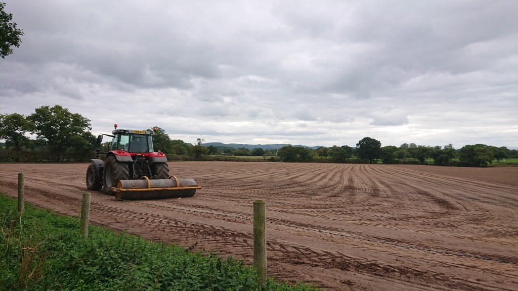
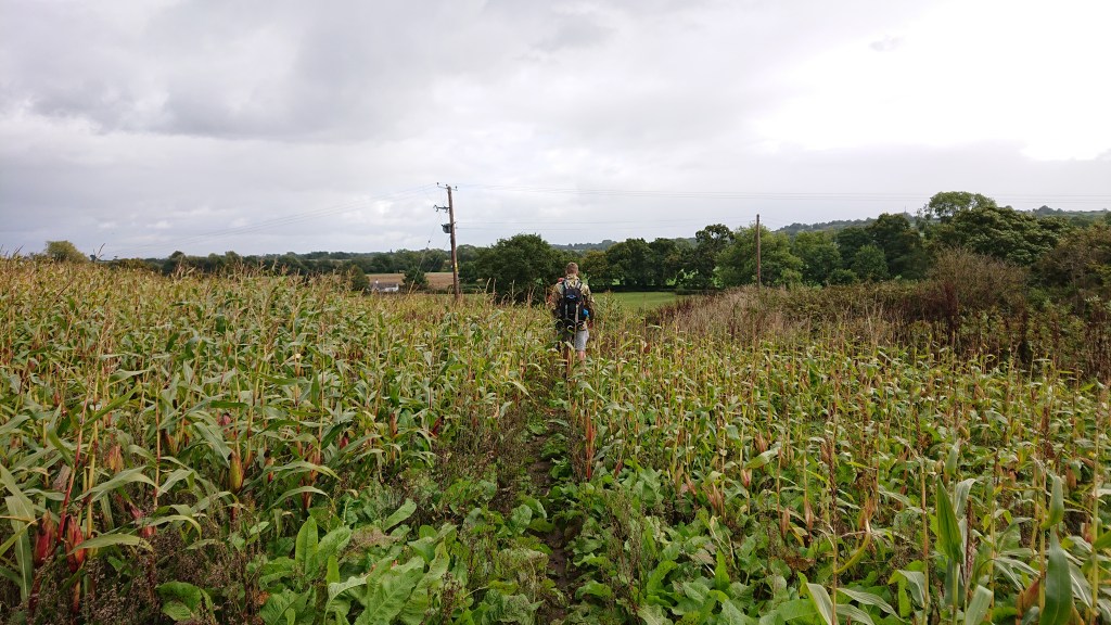
Ahead of us nearly 10 miles of farmland trails. In reality, this is the end of the Sandstone ridge, but for some reason the Sandstone Trail stretches out all the way to Whitchurch – probably so the route goes through all of Cheshire… Who knows?
We had spent most of the morning under trees, and now we were finally entering the fields, the rain hit. Yaaayyyy.
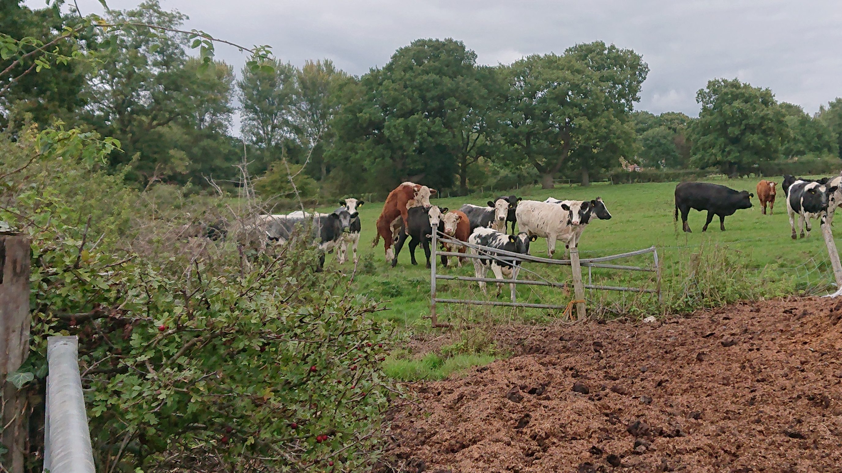
We met more cows…
…some of which we had to duck under live electric fences to get around. We know they were live cos Jack decided to grab one and, shockingly (pardon the pun), got zapped.
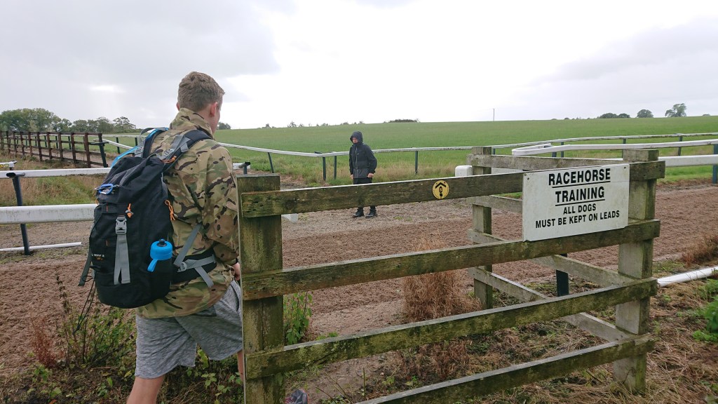
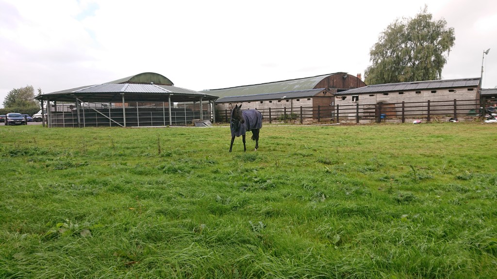
We crossed Manor House Stables racetrack…
…met a horse…
…had a dinner break in a field…
…met some sheep…

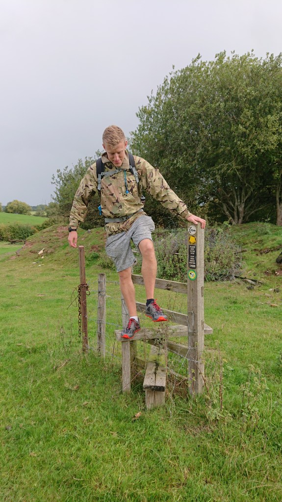
…and watched Jack climb the world’s most useless stile.
After over two hours of drizzly farmland walking, we finally came to a landmark of sorts.
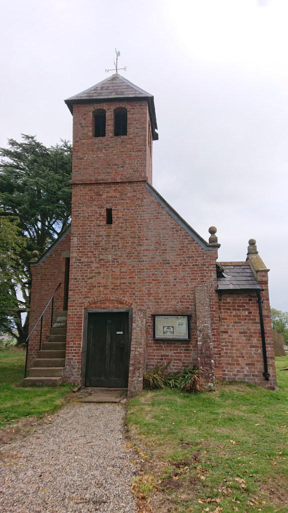
Old St Chad’s – a tiny chapel sitting alone in the fields, now cut off from any roads. It really is a window into the past.
We didn’t stay long at the church, as Sean had really needed a toilet break since Bickerton Hill. I had promised him a pub, not far from Old St Chad’s, called the Willeymoor Lock Tavern. I was quite looking forward to visiting this pub, because of its location – this is a proper canal pub, away from the roads and built to serve those who pass by on barges.

It was shut.
Without having any detours, this is the only pub on the Sandstone Trail – excluding The Bear’s Paw right at the start. So I was really disappointed to see it’s opening times: 12-2pm & 6pm-10pm – but closed on Monday until 6pm. I was gutted we couldn’t have a pint, and Sean was gutted cos he couldn’t have a poo. He thought I was joking when I told him it was closed… the look on his face…
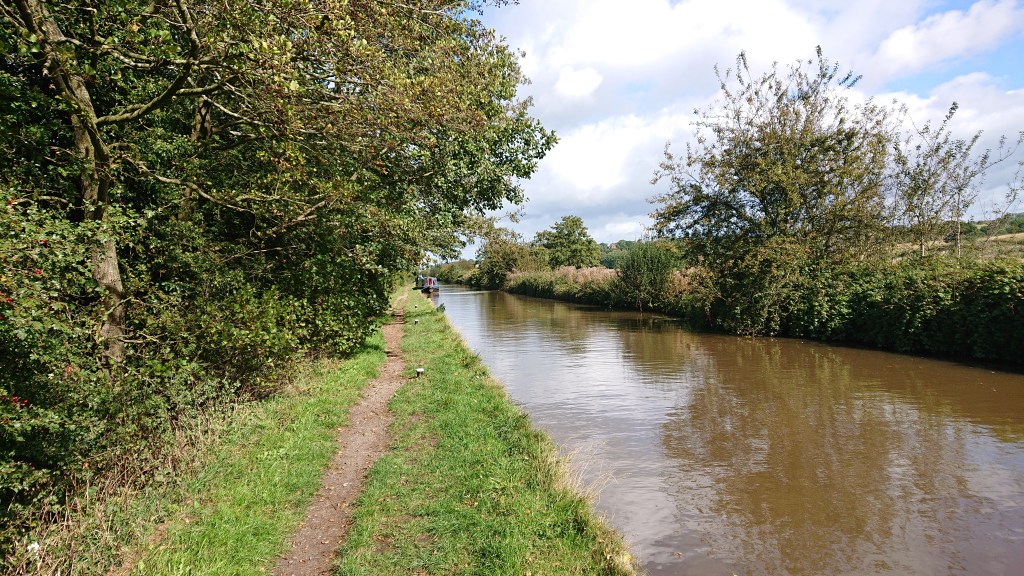
The Shropshire Union Canal to Whitchurch
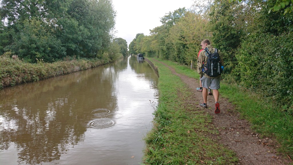
The mood was low as we pressed on along the canal. We tried to cheer ourselves up with a game of I Spy – that’s how dire it was.
I tried to comfort Sean by telling him that there was another pub called The Horse and Jockey, just off-route in the village of Grindley Brook. We were literally just a few hundred metres from the village when Sean disappeared behind us.
He couldn’t wait. He climbed down into the bushes to the left and deposited some Baby Seans into the Grindley Brook. Our first and only wild poo of the trip. As he was doing his business, I discovered that The Horse and Jockey was also closed on Mondays. I don’t like the opening hours of pubs in this part of the world.
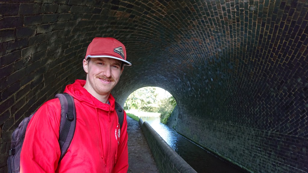
Sean rejoined us feeling much lighter and we entered Grindley Brook village, crossing the border into Shropshire as we did. Passing through a tunnel, marvelled at the brickwork.
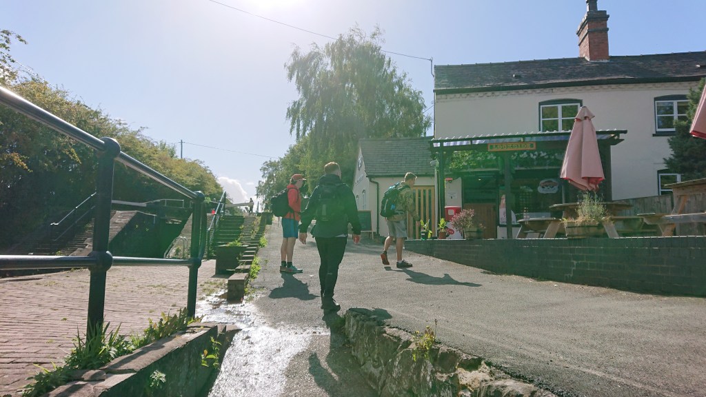
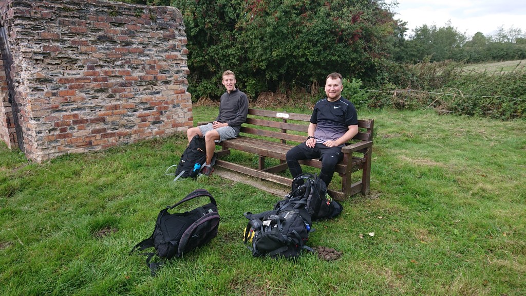
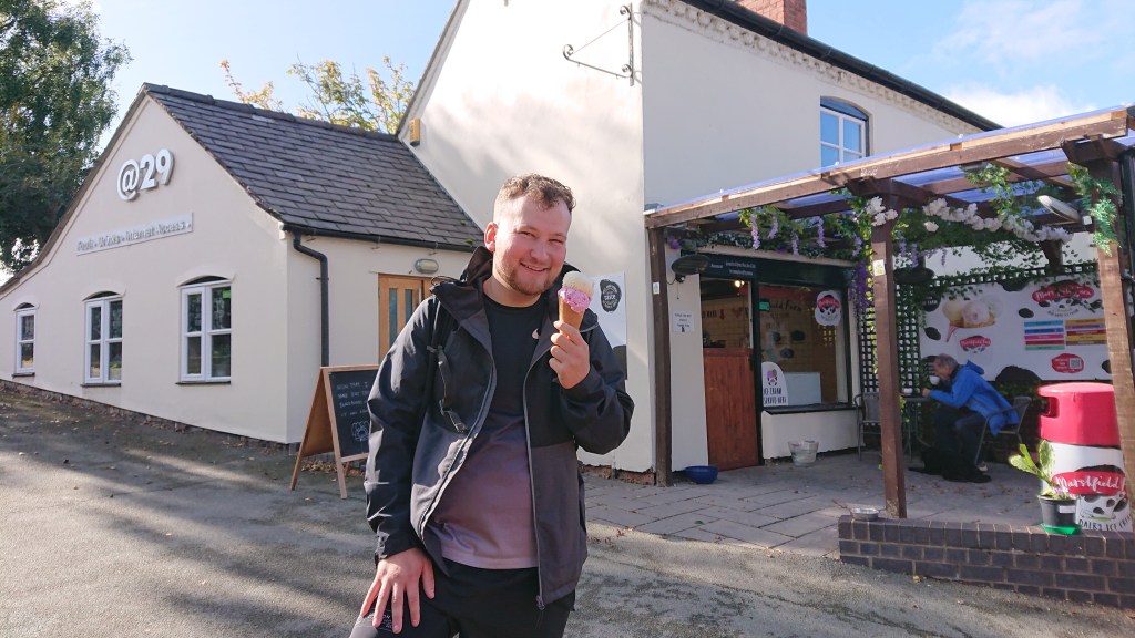
FINALLY! Somewhere open! We stopped at the Lockside Cafe for a bit and Sean bought an ice cream, to fill the recently emptied void in his tummy.
Grindley Brook is a very pretty little village, especially in this weather. It features a cafe, a pub (when it’s open) and also a public toilet, which Sean and Jack both ran off into (Sean had more parcels to deliver).
After our final break of the day, all that was left was to follow the canal into Whitchurch, until it ended.
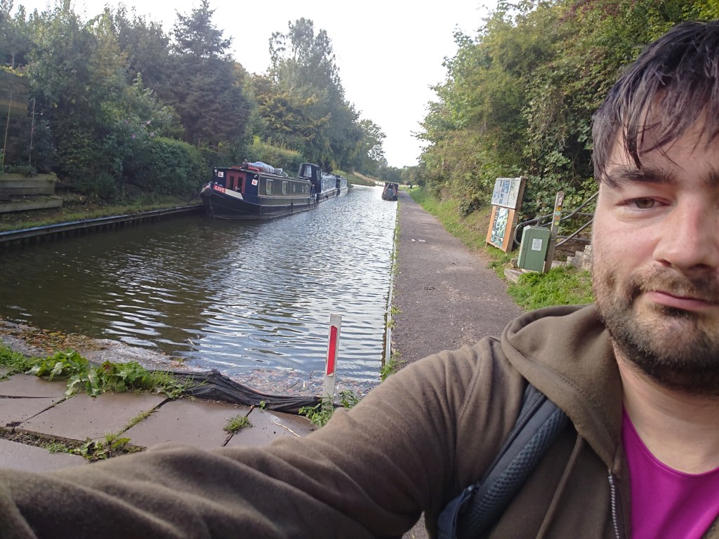
That’s the face of a very achy man. By this point of the walk my feet were in bits. My little toes felt like they’d crumbled into a million pieces and my big toes felt like they were on fire. The pain in my feet was constant cramp.
But we had made it to Whitchurch. We navigated our way through the residential areas – again with the easily spotted Sandstone Trail signposts.
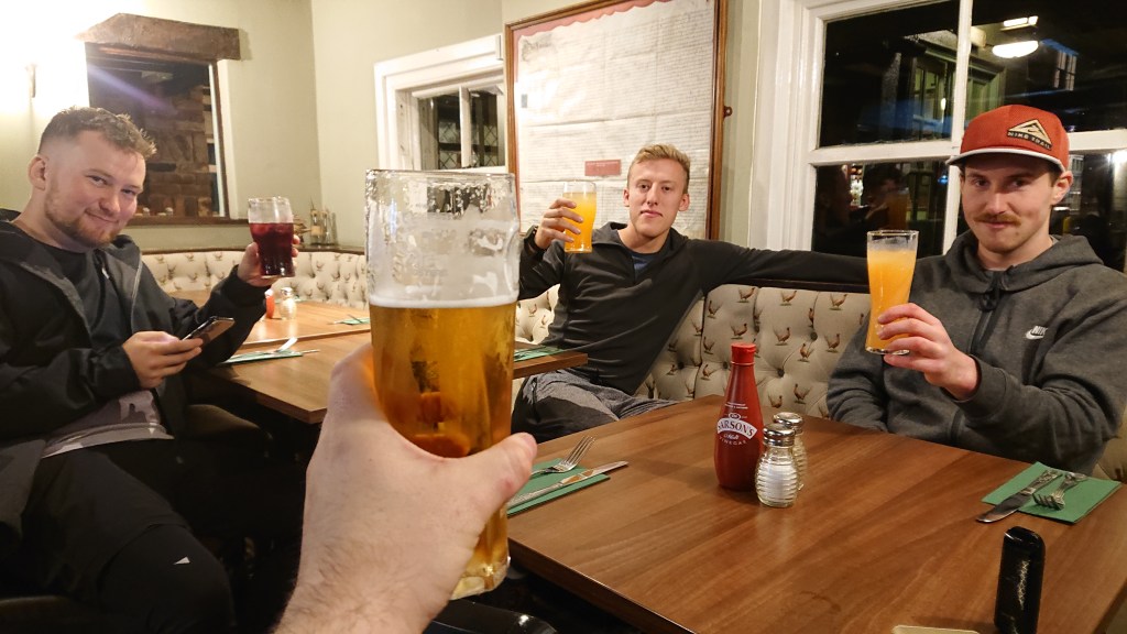
At 3:05pm, 28 hours and 59 minutes after beginning the Sandstone Trail, we finished it.
One word: DONE.

Our walking time was 14 hours and 36 minutes.
So, thoughts…
- It’s a great trail that takes in many of Cheshire’s western landmarks
- There are loads of viewpoints to take in vistas on sunny days.
- We walked north to south, to get through the more difficult sections first.
- The Bickerton-Whitchurch section is a little dull – which could persuade you to walk south-north and get the farmland section out of the way.
- There’s a severe shortage of pubs on the trail (without having to take a big detour into the nearest village/town).
Would I walk it again? Yeah, probably.
