“It’s the 3rd best walk in Britain, I found out today” – Brendan Clayton, 2021.
The best place to park for any kind of walk around Malham in the Yorkshire Dales is at the Malham National Park Centre. There’s a large car park with loads of spaces – but it does fill up so arrive as early as you can! An all day parking ticket costs £4.80 and a 24 hour ticket costs £5 – if you fancy sleeping in your car/van overnight for a super early get up.
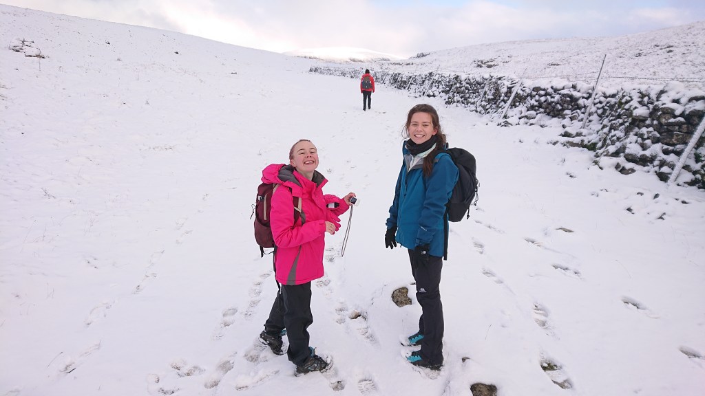
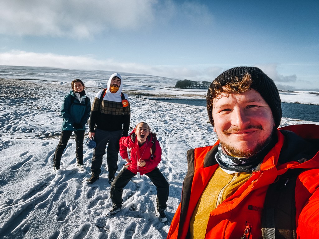
As it was the 28th of December and snow was falling across the country, none of us fancied sleeping over in a freezing cold car. Brendan, Sam and I arrived at 8am. After her ordeal on Blencathra in November, it was surprising that Sam had not blocked Brendan and me from ever inviting her on The Walking And Talking Society outings. But today’s route was not a strenuous one, and Sam brought along her co-Kili-climber Emily to enjoy the snowy landscape.
Again, I must share this link. If you haven’t already, dig your hands in your cyberpockets and donate to the girls’ cause:
https://uk.virginmoneygiving.com/SamsKili
Here’s Brendan’s route.
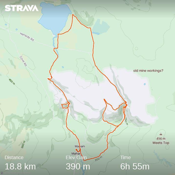
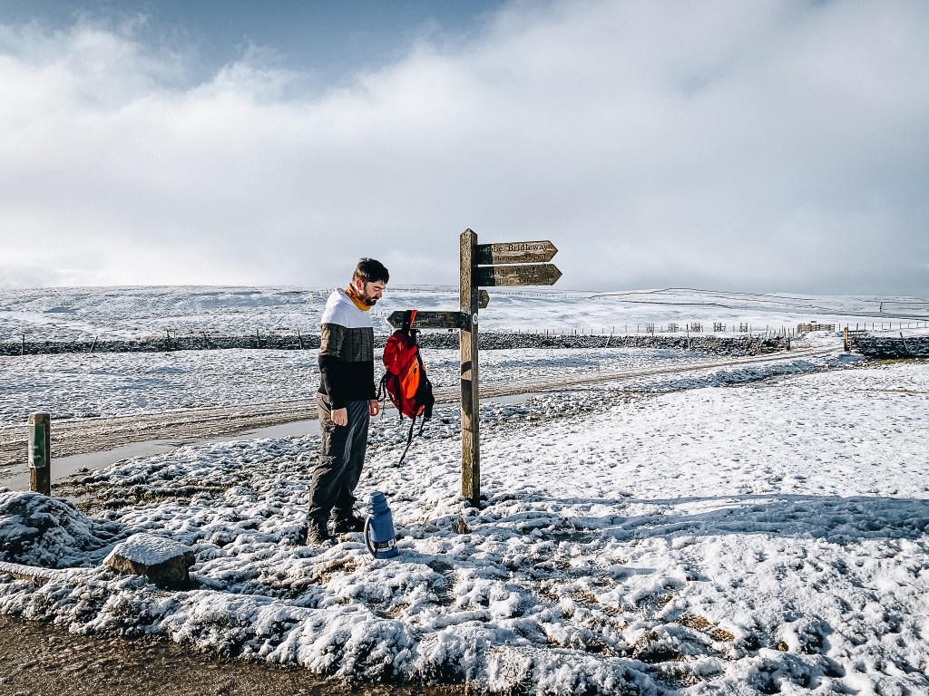
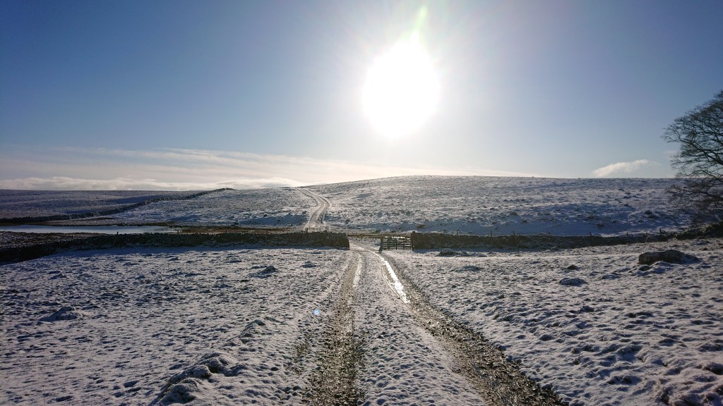
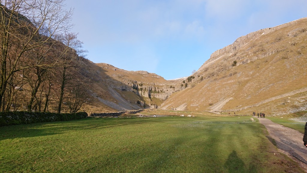
We started in Malham village and took the clockwise course. It’s the standard route for seeing Malham’s main attractions: Malham Cove, Malham Tarn, Gordale Scar and Janet’s Foss. The area is well signposted.

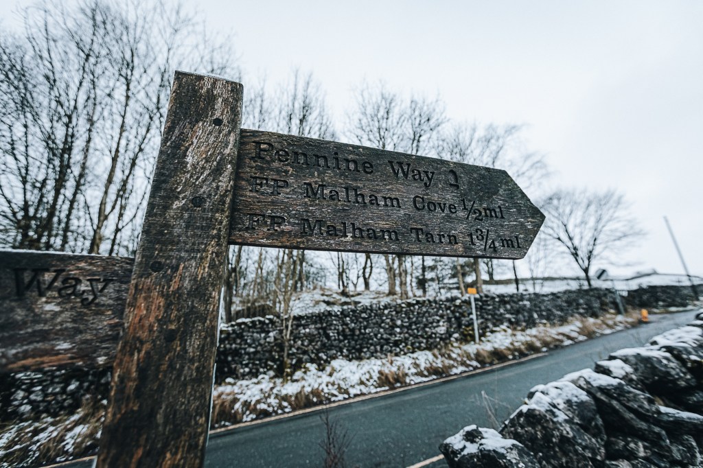
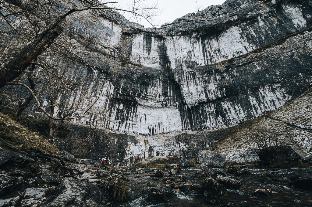
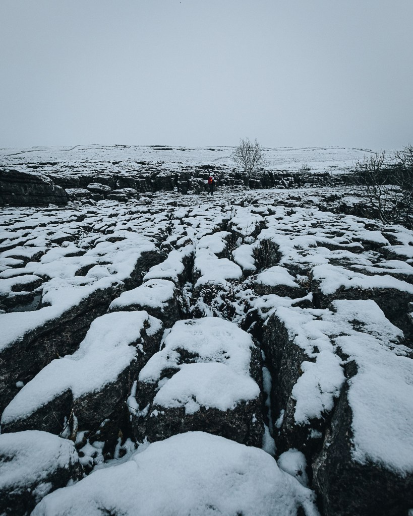
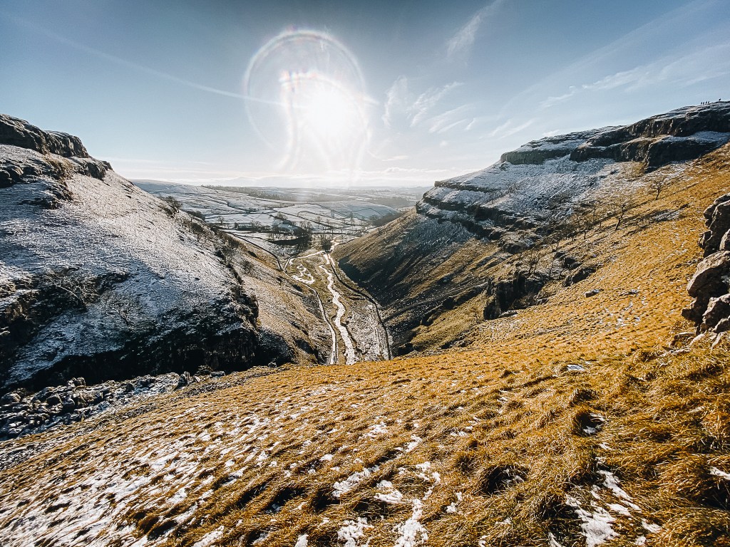
Our first point of interest was Malham Cove. We walked northwards through the village, and onto the Pennine Way which at this point runs parallel to Malham Beck. Fairly soon into the walk we rounded a bend and Malham Cove appeared in the distance.
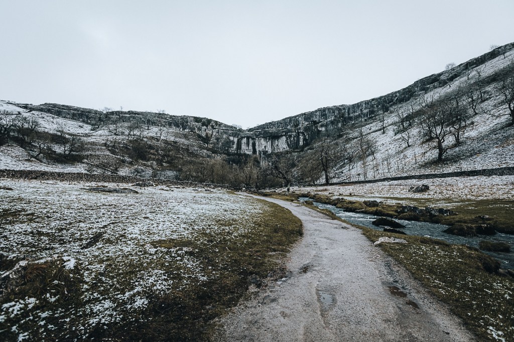
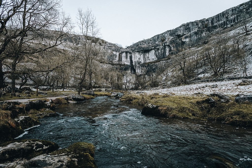
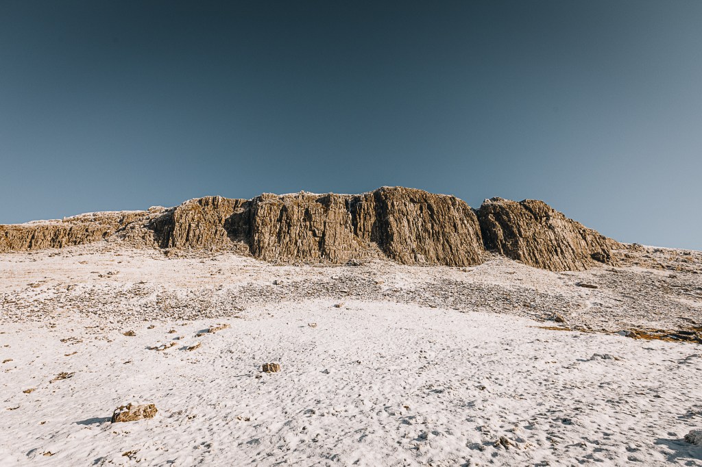
The cove was formed by an Ice Age river that fell over the limestone cliff as a cataract-style waterfall (think Victoria Falls – imagine water pouring off the entire cliff). The curved shape is created because the lip of the cliff is more heavily eroded in the centre – where the majority of the water cascaded over.
And people say I’m boring lol.
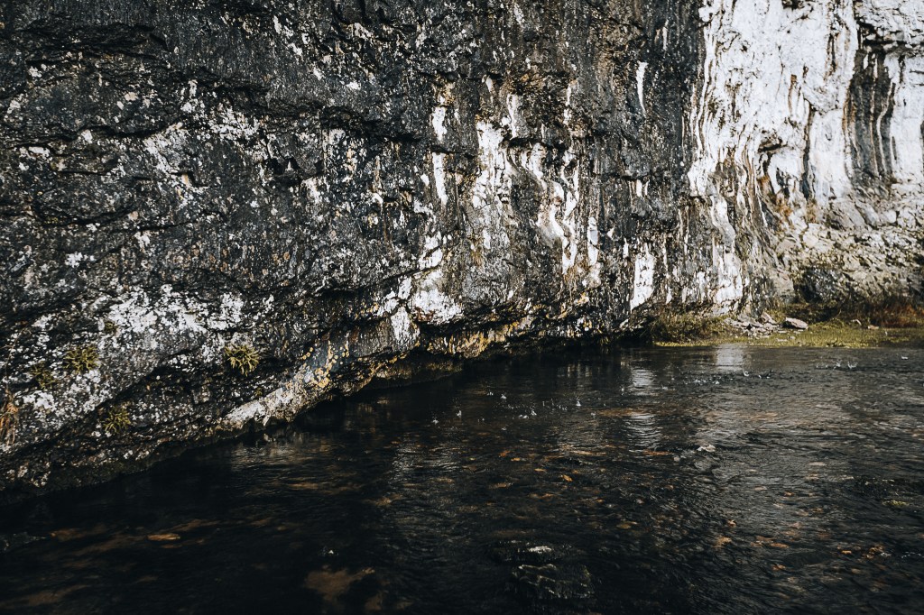
The river no longer falls over the cliff. Now it sinks into the ground a mile upstream at a place called “Water Sinks”. It filters through the limestone and seeps out of the rock at the base of the cove.
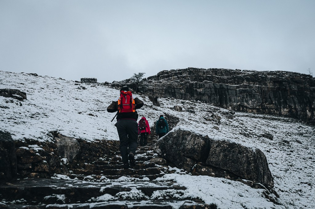
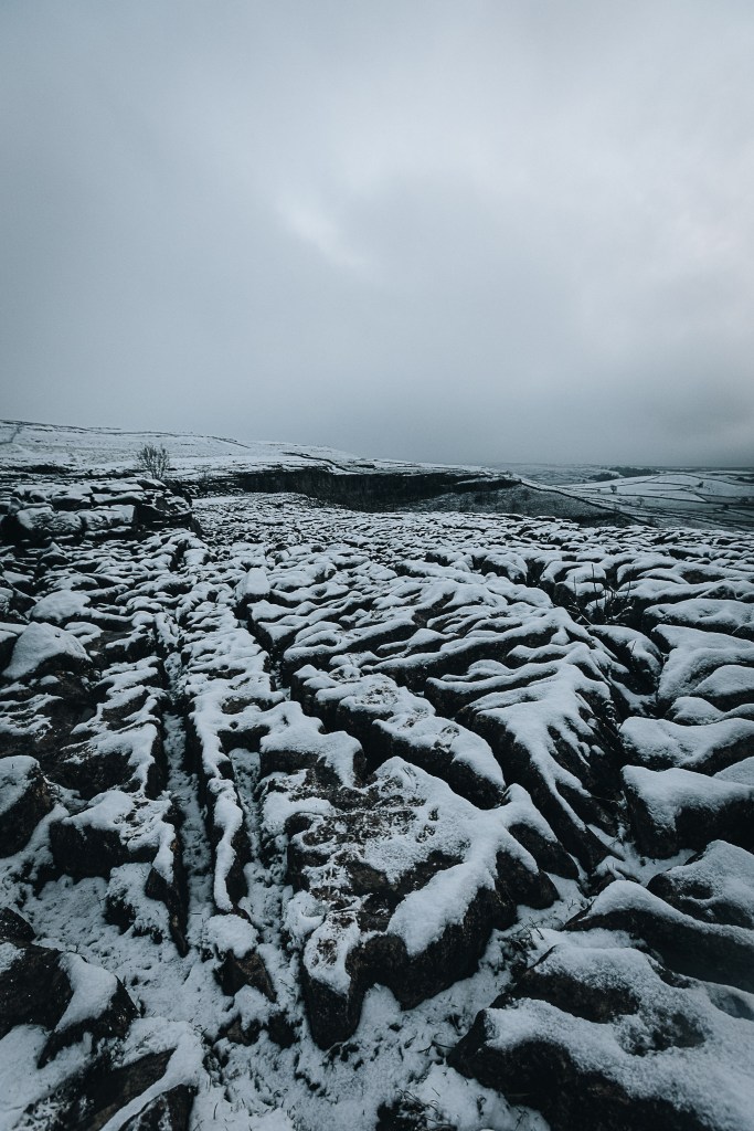
We rejoined the Pennine Way and climbed 414 stairs to the top of Malham Cove. Up here is a strange area of deeply eroded limestone.
It’s a killer on the knees (if you’re old like me) – and even worse in the snow! Incredibly, I didn’t once slip/trip over.
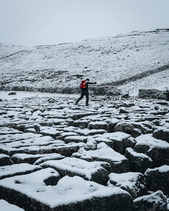
If you’re a big Harry Potter nerd like me, you might recognise this landscape (if you ignore the snow). The top of Malham Cove was used as a setting in the making of Deathly Hallows – Part 1, where Harry and Hermione apparate without Ron. It’s the scene when they decide to visit Godric’s Hollow. Yaknow.
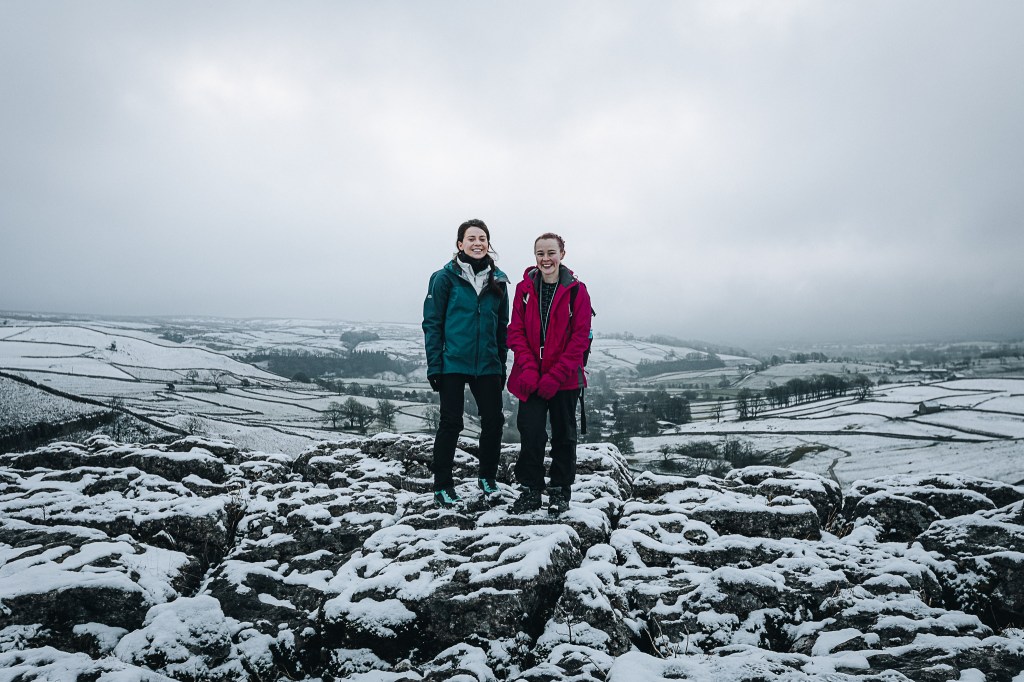
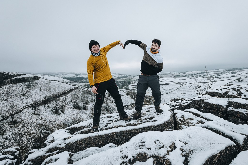
There are some great views from up here. Even on a misty, snowy day. The poor weather meant we had this usual tourist honey trap all to ourselves. So I threw some snowballs off the edge.
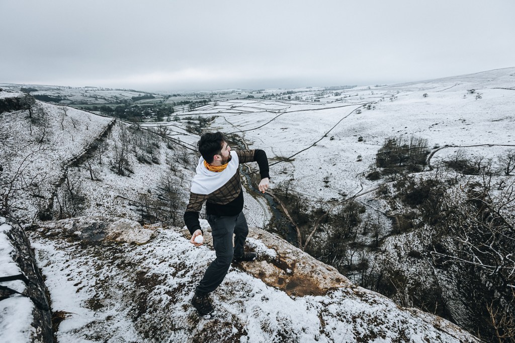
They took ages to hit the floor. Anyway, enough fooling around. Onwards to Malham Tarn!
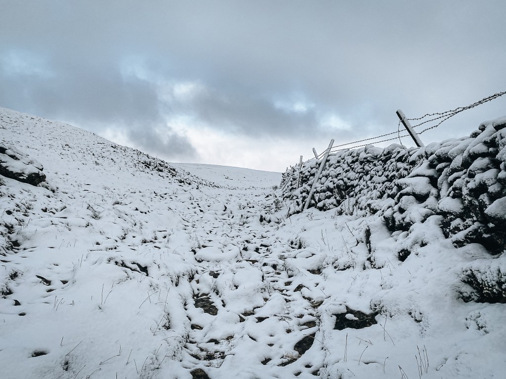
This section of the Pennine Way takes you up the old riverbed. As the path became hillier, it felt more and more like I was hiking Beyond The Wall in Westeros.
We came across a small cave in the rock. Being nosey buggers, Brendan and I had to have a look inside.
It wasn’t deep and it was pretty damp. Not the best place to hide from the weather or the Wildlings…
We carried on towards Malham Tarn. Smiles appeared on faces as blue sky appears above us.
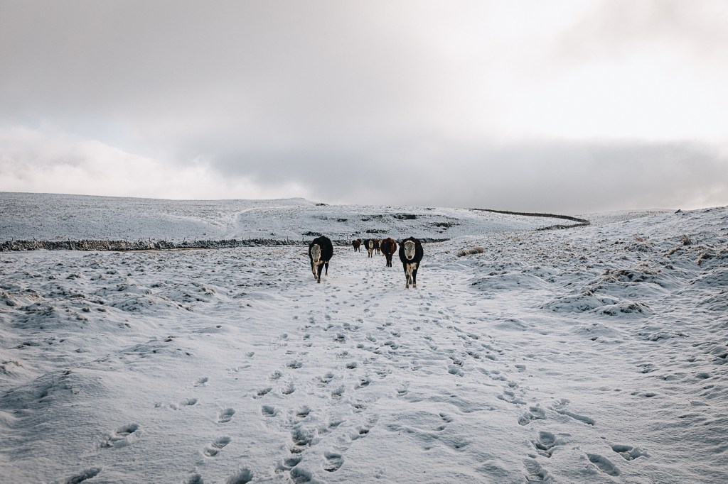
We reached Water Sinks where – you guessed it – the water simply sinks into the ground. There’s no giant hole. The earth kinda absorbs the stream like a sponge. It’s a strange place and it was guarded by an army of cows who were very interested in us T.W.A.T.S.
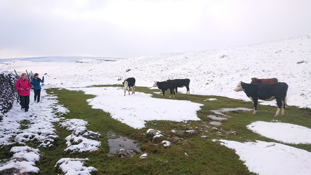
They came over to stand and stare and moo at us. Sam and Emily were particularly uneasy. I don’t trust cows. We calmly walked by and the cows decided to follow us/escort us out of the field.
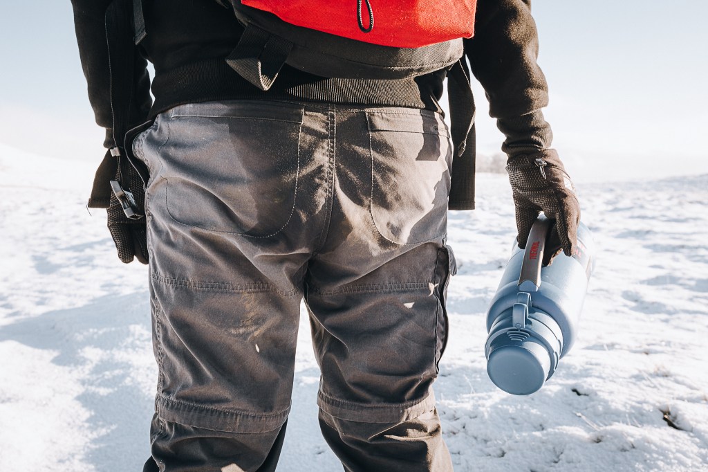
It was around now that Sam remarked that I had a wet arse. Brendan informed her that that was a T.W.A.T.S. adventure norm, before also noting that my behind was particularly damp. Tbh, I had felt the wetness but I thought it was just the result of making a snow angel earlier. If only that were true.
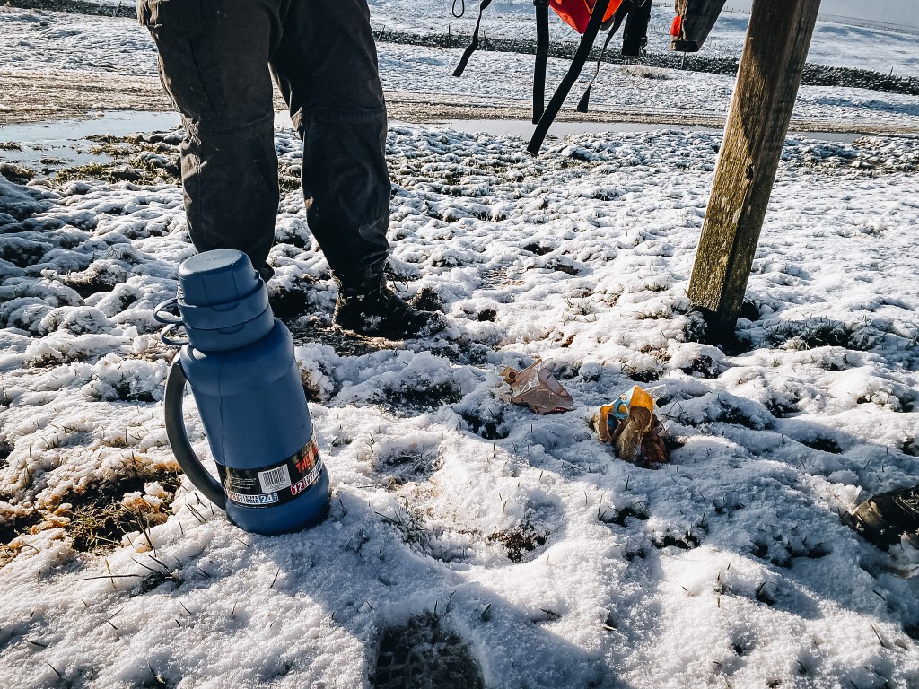
I don’t recall throwing my bag down at all but at some point, my flask had decided to shatter inside. Tea was oozing out – thankfully not the entire 2 litres, but enough to soak my arse and ruin my sandwiches. No dinner for me!
BTW, we had reached the Water Sinks car park you would use to visit Malham Tarn. The roads were incredibly icy. I am glad Brendan had not insisted we meet here in our cars.
The lake looked incredibly cold and I didn’t follow Brendan down to the water’s edge.
Malham Tarn is one of only eight upland alkaline lakes in Europe with a pH of between 8.0 and 8.6. So it’s probably best you don’t drink the water.
With no bins around here, I had to carry my shame with me – figuratively and literally.
We stopped in a field by the Tarn for dinner (I had a packet of crisps. My fellow T.W.A.T.S. did offer food, but I refused, for this was my burden to bear) and Sam shocked us all by revealing she’d never built a snowman. How can you go through life without building a snowman ffs??
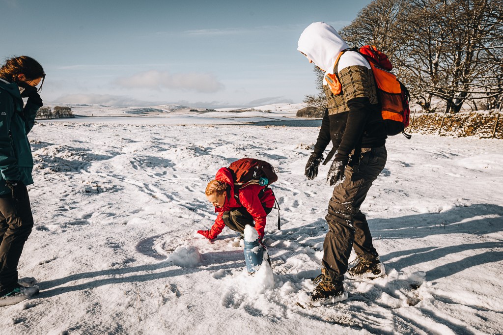
Although she tried, this type of snow was not suitable for snowman building. It was too fresh and fine. But she did try.
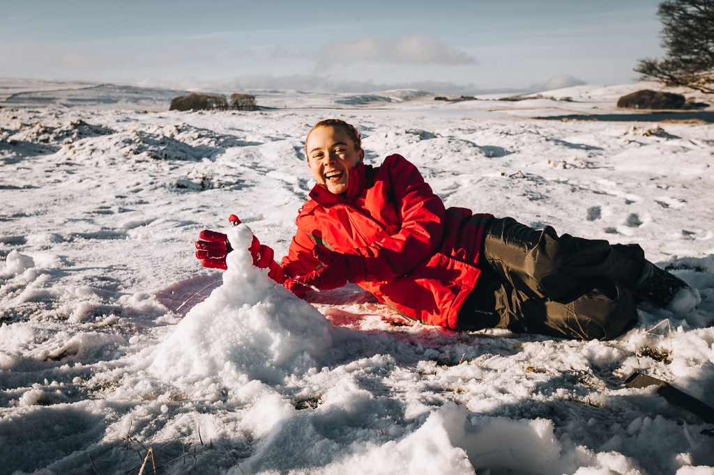
You never forget your first, Sam.
On the eastern shore of Malham Tarn we left the Pennine Way before it passed Tarn House. We joined the path that shadowed the ridge called Great Close Scar.
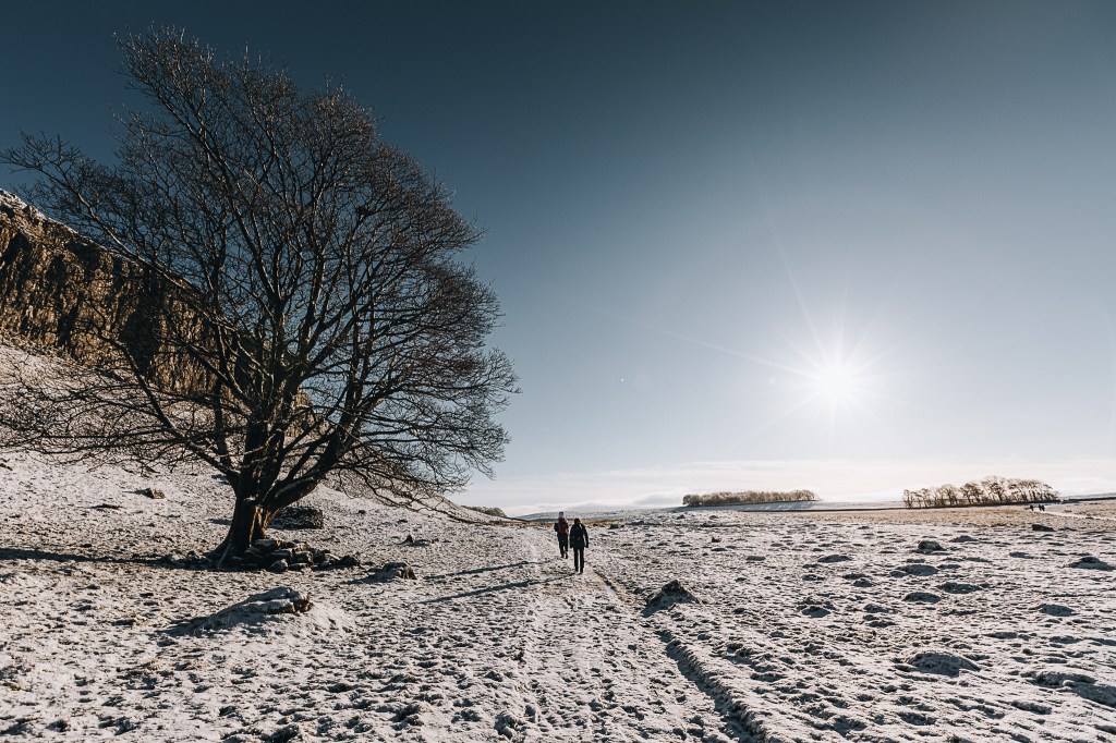
The land was verrrrry white. There were barely any other footprints in the snow. The wind had died down. The sun was weakly but pleasantly warming us. It was very tranquil.
We joined the road that taken southwardly leads you to Gordale Scar – a ravine containing two waterfalls. We passed a flock of hungry sheep…
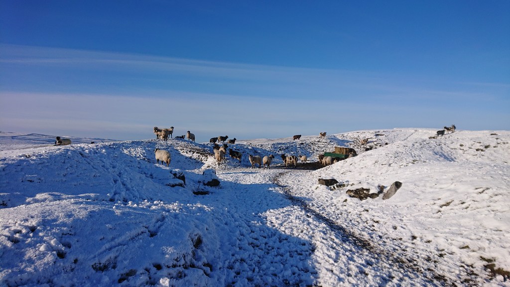
(they smelled very sheepy)
And a cool tree.
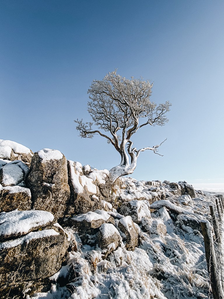
So cool it had icicles hanging from it, glinting crystal-like in the sunshine.
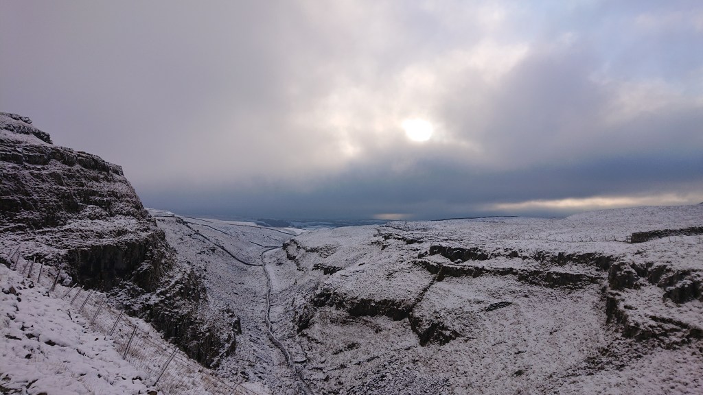
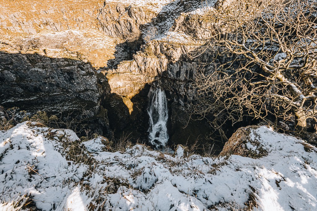
We crossed a stile and joined the path that leads directly to Gordale Scar. There is a pathway directly down through the gorge and I wanted to see if it was traversable. With it being midwinter, I wasn’t confident, but it was worth a look.
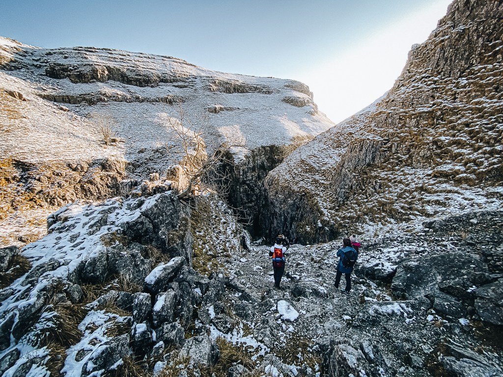
We had been following some footsteps in the snow that headed down the path. There weren’t any coming back up so for a brief time I thought maybe we’d be able to get down. We eventually saw a group of foreigners down the gorge, struggling to walk back up. The waterfall was too strong at this time of year. Maybe another time!
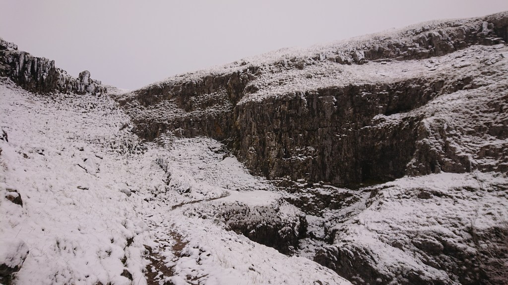
We walked up and around to find a way down. This way was a dead end but Brendan took his camera down to the cliff edge to capture the upper torrent.
I was happy to wait and see his photos instead.
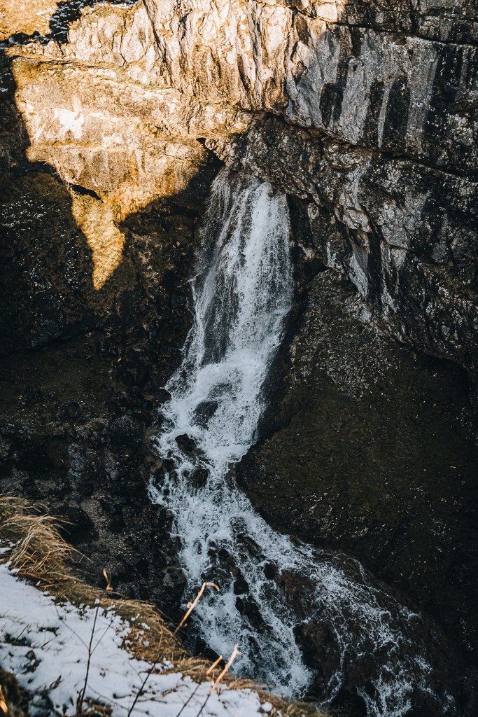
We took a wider route down to the bottom via another, more negotiable gorge which led to Hawthorns Lane. We approached the Scar from the bottom.
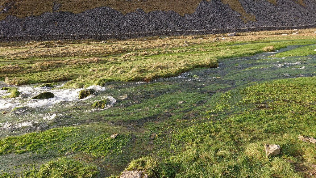
The Gordale Beck was particularly swollen. Water was running across the grass. My eyes found it delicious.
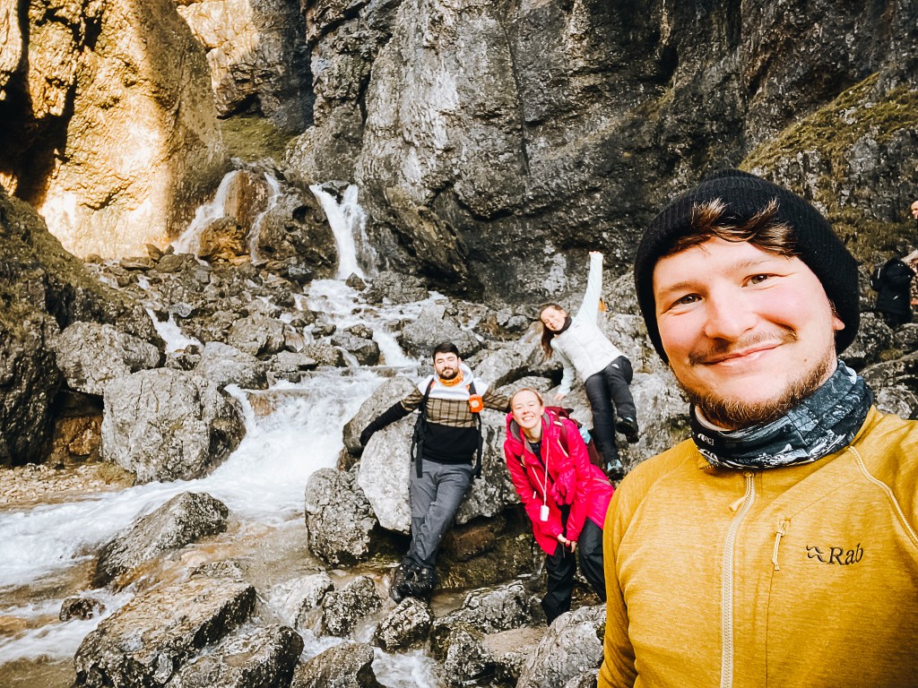
It was past 2pm now so there were more people around but we managed to find a break in the crowd and got close to the lower waterfall.

Somehow, you can climb up through there. It looked just a tad wet and slippy to me.

THANK GAWD the little refreshments trailer was open, even in these Covid Times.
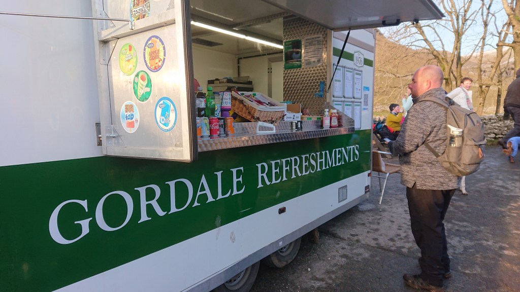
The sausage butty with brown sauce was a welcome substitute to my tea sodden sandwiches. And the prices weren’t too horrific either! Northern prices.
The path back to Malham from the Scar follows the Gordale Beck. Just downstream from the ravine is Janet’s Foss. The word “foss” is Danish and is where we get our English word “force” from. A lot of waterfalls in this part of the country are called something “Force” and that’s likely down to the north-east’s links to the Vikings.
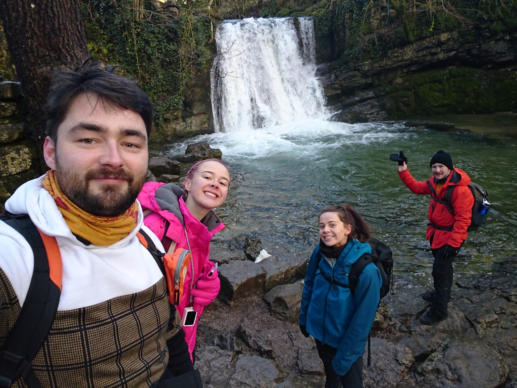
An excellent place for a summertime swim, I’m sure. Not today, though.
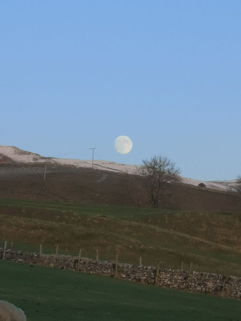
With the sun setting we headed back to the village and were treated to a cold looking moon sitting large on the horizon.
This circular route around Malham is a great walk for anyone. With our various excursions from course we walked for 16.4km. It’s not at all difficult and takes you past loads of beautiful Yorkshire Dale countryside. But of course, its accessibility means it’s often full of other ramblers so if you love walking but hate people, it’s probably best you visit before most others have woken up. Or else, visit in the depths of winter.
Here’s the 3D animation of our ramble:
And Sam did a cute little video diary of the walk:
Happy 2021 everybody!
