November 4th 2020. The last day of “freedom” before England entered Lockdown 2.0. Best make the most of it!
I drove my fellow Winsfordian Sam Lyon to meet Brendan Clayton at the foot of Blencathra (AKA Saddleback), the 17th highest Wainwright in the Lake District.
We parked here:
54°38’09.1″N 3°00’35.6″W
From the A66, take the turning at The White Horse Inn and follow the narrow road. The lay-by is pretty small, with only space for around 10 cars. I had to carefully squeeze my Corsa between a car and a muddy slope. There is a space for two cars right opposite the beginning of the trail, up a fairly steep grassy bank. Not ideal. The earlier you arrive, the better!
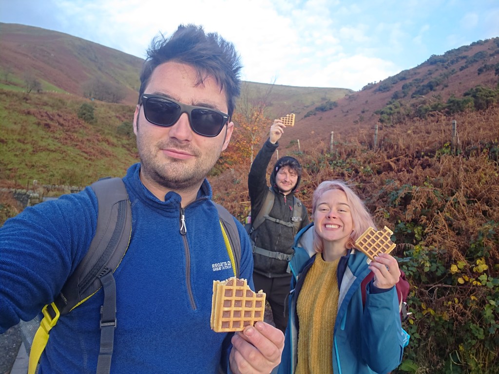
We fuelled up on The Walking And Talking Society’s favoured breakfast items – chocolate filled waffles from Aldi.
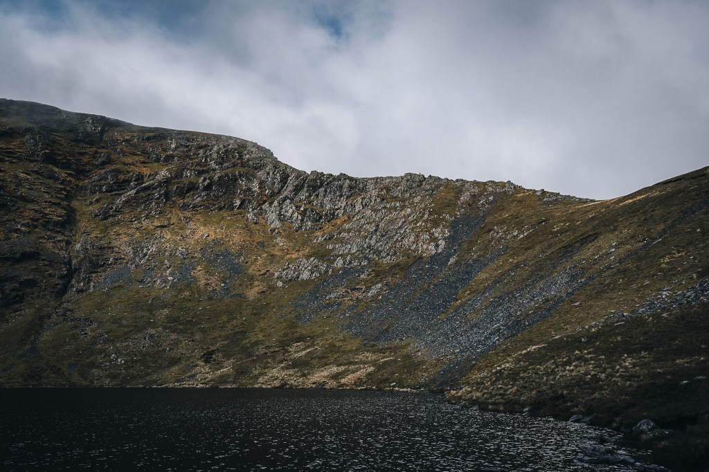
We’d picked a good morning for it!
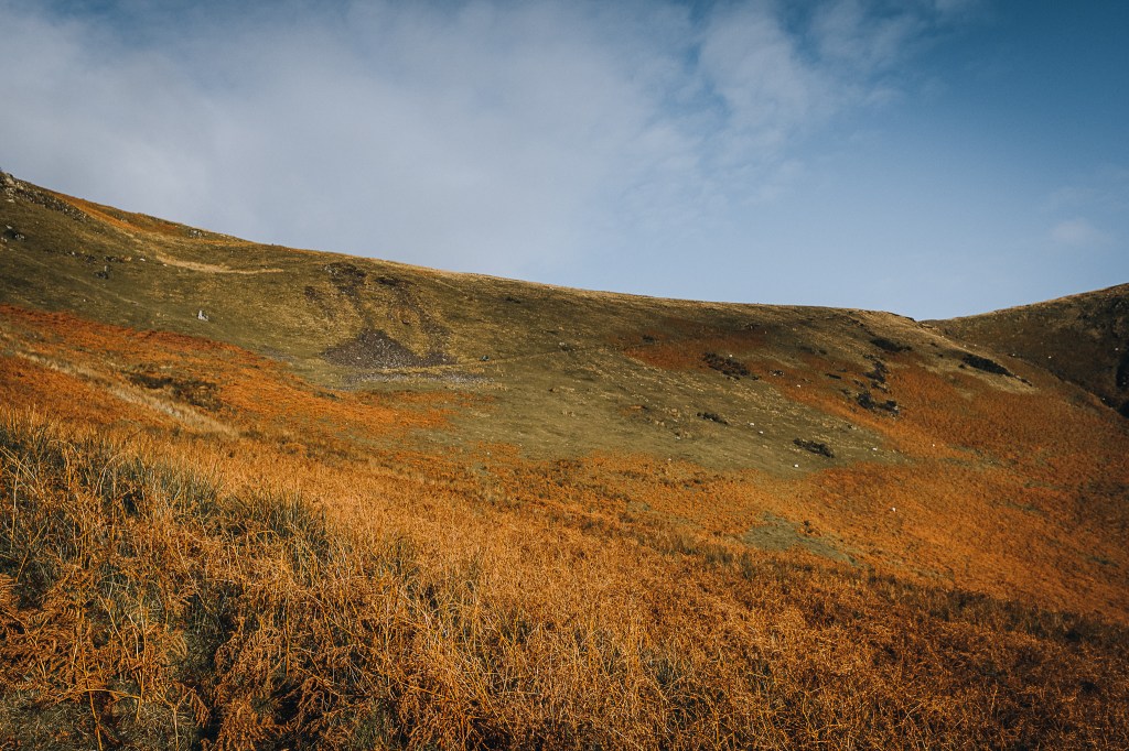
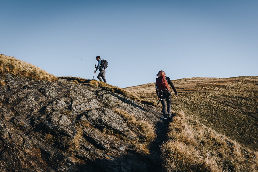
As it’s November, the heather is very brown. This initial stage of the hike is moderately steep. Already my back was starting to hurt. I was feeling nervous about the day ahead.
The reason Brendan had chosen the 17th highest Wainwright was so we could climb the aptly name Sharp Edge, an arête on the northern ridge up Blencathra. It’s a Grade 1 scramble – so that should make it easy and non-lethal, right? My only prior experience of scrambling along an arête had been one horrific day on Crib Goch in Snowdonia. And that was Grade 1 too. I do not enjoy arêtes. I knew Sam would not enjoy an arête. But Brendan insisted and I agreed so long as the weather was perfect. Annoyingly, it seemed the weather was indeed perfect. Gulp.
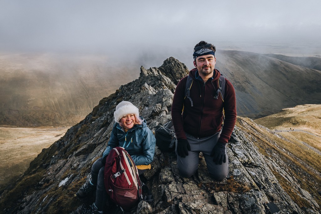
Poor Sam did not know what she was getting herself into. I knew that smile would not last long…
2020 has been pretty crap for us all, but Sam suddenly and unexpectedly lost her dad earlier in the year, not long after a corona-cancelled first trip to Africa. In desperate need of something positive to look forward to, she applied in a local competition looking for young women in Cheshire who would be interested in climbing Kilimanjaro. And of course, she made it onto the team. I say “of course” because Sam is one of the most lovely, infectious people I know.
In February 2021, Sam will (Covid-permitting) climb Mount Kilimanjaro in Tanzania, sponsored by Active Cheshire, a charity who aspires to embed physical activity into people’s everyday lives, through educating, enabling and inspiring the local community of Cheshire and Warrington. Her campaign is in aid of Warrington Youth Club.
PLEASE SUPPORT SAM. She bloody deserves it.
https://uk.virginmoneygiving.com/SamsKili
At 5,895m high, Kilimanjaro is a cool 5027m taller than Blencathra. But any training is good training I suppose!
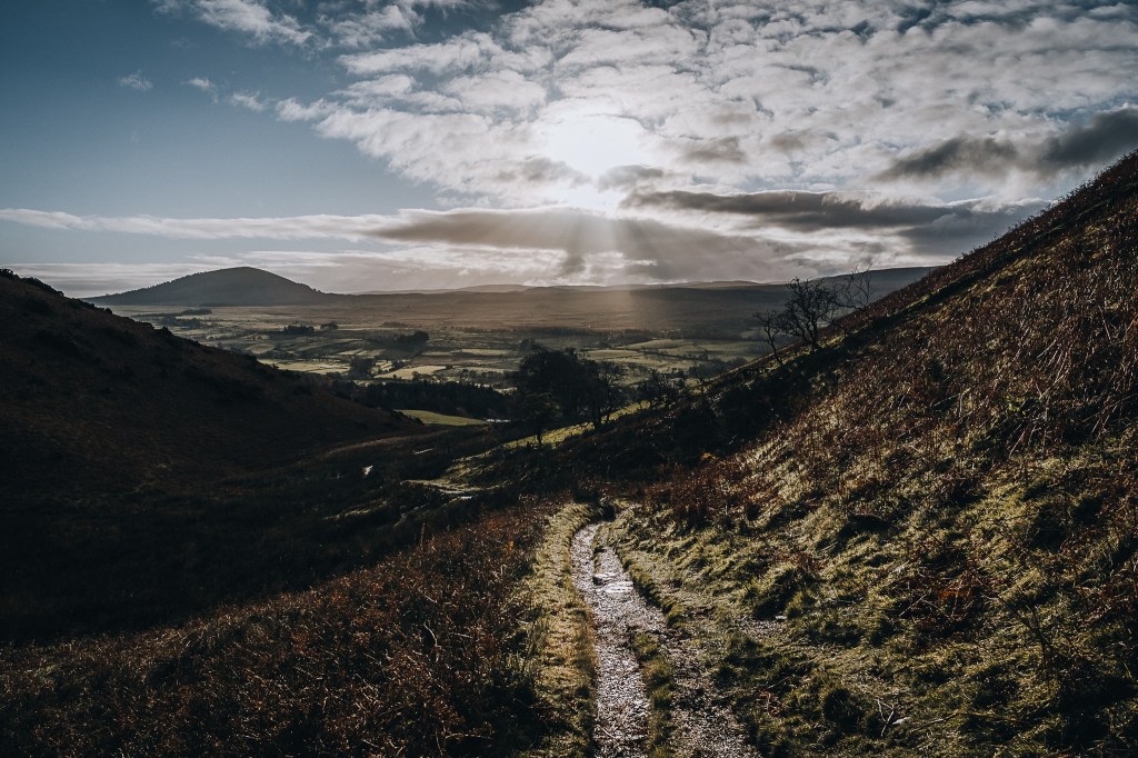
Eventually the steepness levels out as you reach the shoulder of the mountain.
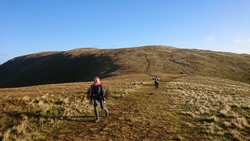
It’s very open up here but the breeze was weak. On a windy day I imagine your eardrums get popped.
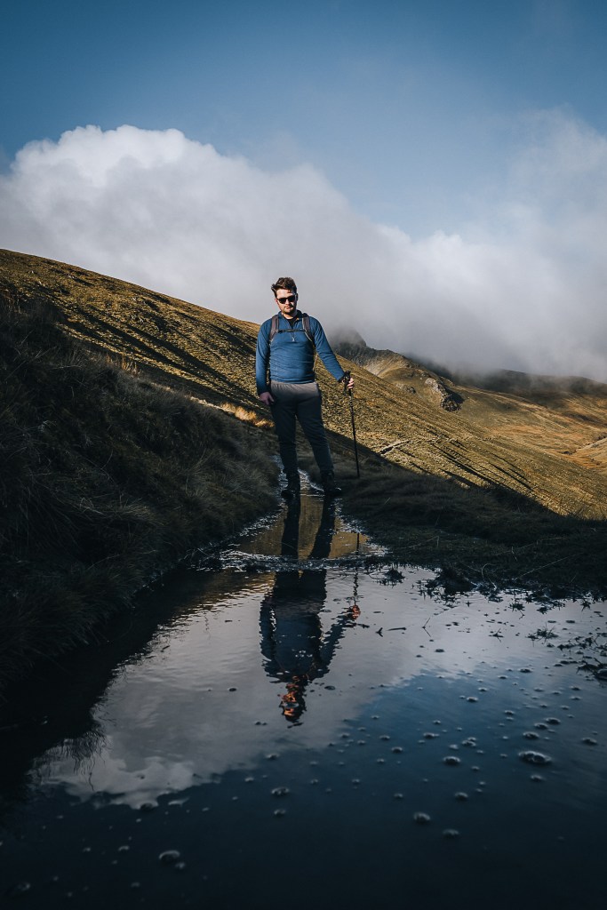
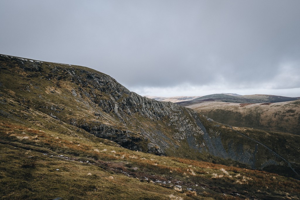
In the distance we could see Sharp Edge.
Or, at least, where Sharp Edge should be. I’ll be honest. I wasn’t feeling it.
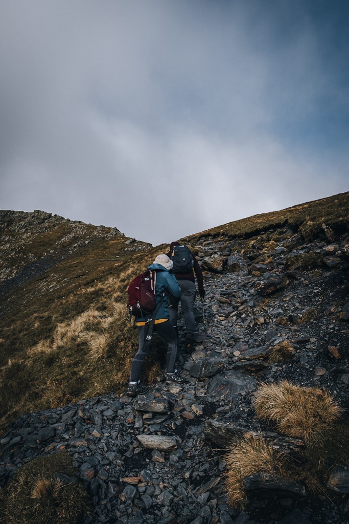
There are a number of ways up to the Blencathra summit. From this point on the shoulder, you can turn left and take the much, much easier route up to the top via Scales Fell.
So we turned right and headed towards Scales Tarn and Sharp Edge.
This part of the trail runs parallel to the River Glenderamackin, and some parts of the footpath are itself underwater.
This didn’t bother me in my water resistant Jack Wolfskin boots. I’ve had them for over two years and they are pretty decent at keeping the water out. Sam’s boots however were not so impervious.
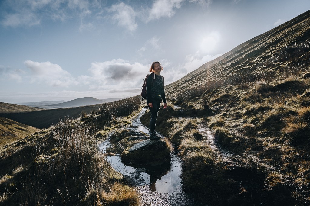
We often had to wait for her to plan a route across the puddles. This bode well for when we had to cross the river.
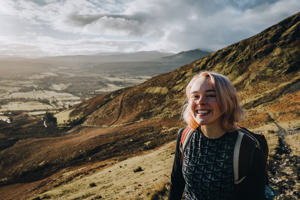
It was at this point that I finally appreciate Sam’s complaints that her legs were too short.
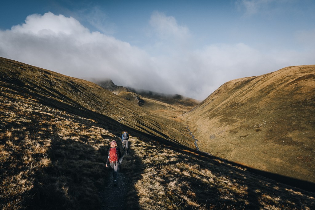
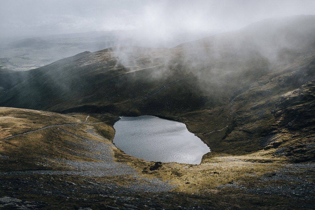
A sharper incline had returned as we hiked beside the waterfall up to the Scales Tarn.
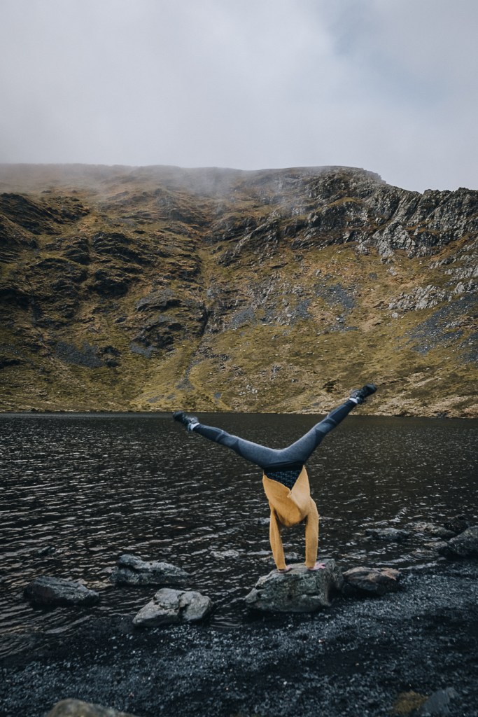
The cloud that had previously enveloped Sharp Edge had completely cleared. Great news.
We sat by the lake for a short break. As I secretly wished for the sudden appearance of a horrific cloud, Sam did some cartwheels by the water.
Sadly, the clouds were not forthcoming and much to Brendan’s delight, we headed for Sharp Edge.

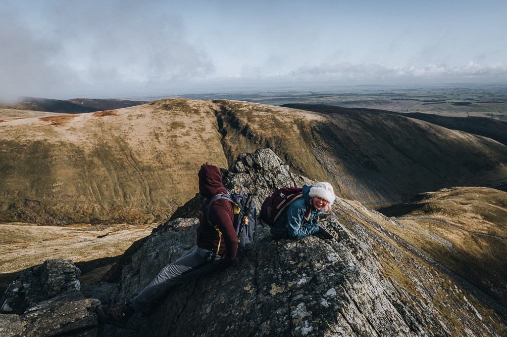
There is also an easier path to the top from Scales Tarn, as seen in the background here, where the chances of slipping and tumbling down a cliff are vastly reduced.
The steep trail soon disappeared entirely. It was replaced by spiky rocks.
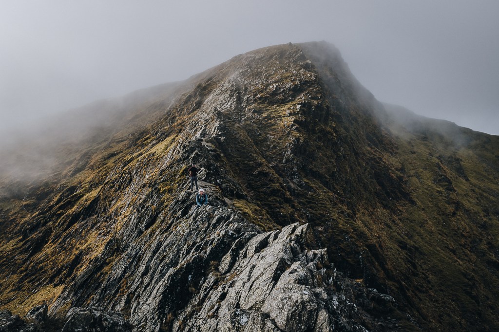
Sharp Edge by name, and by nature. There are parts here where you can risk your parts and straddle the mountain.
It’s a place to get used to being a quadruped – unless your name is Brendan Clayton.

I just don’t have his confidence. Maybe I’m a pessimist but I can’t scramble these arêtes without constantly imaging myself plummeting off the edge.
The views were impressive, but they only served to remind me how far I had to fall.
As expected, Sam was on my side of the fence when it came to the enjoyment of ridges like this.
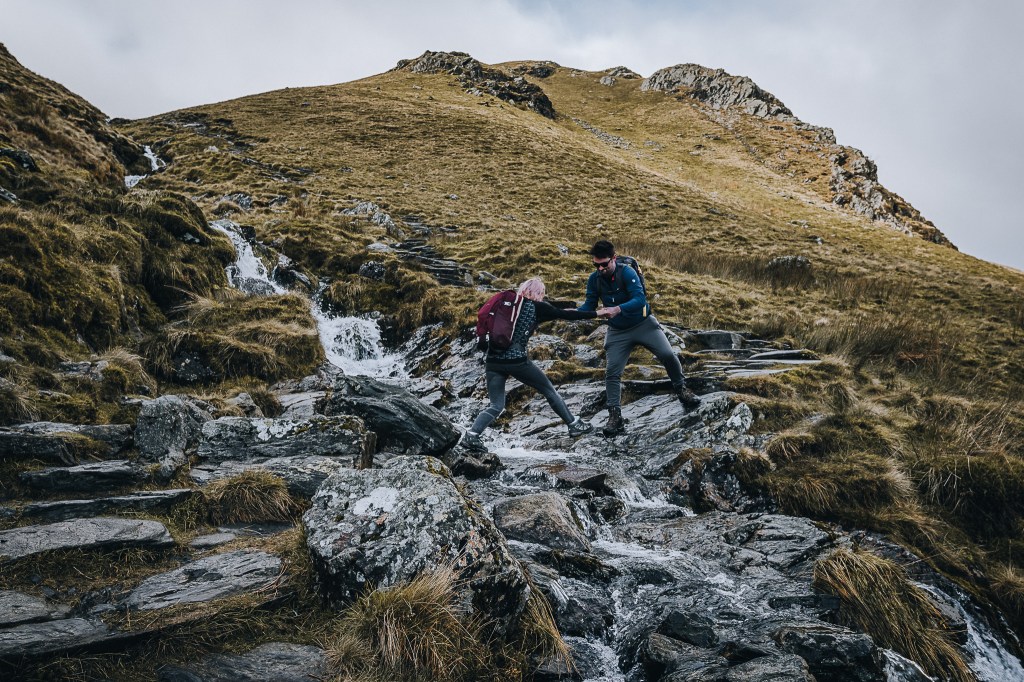
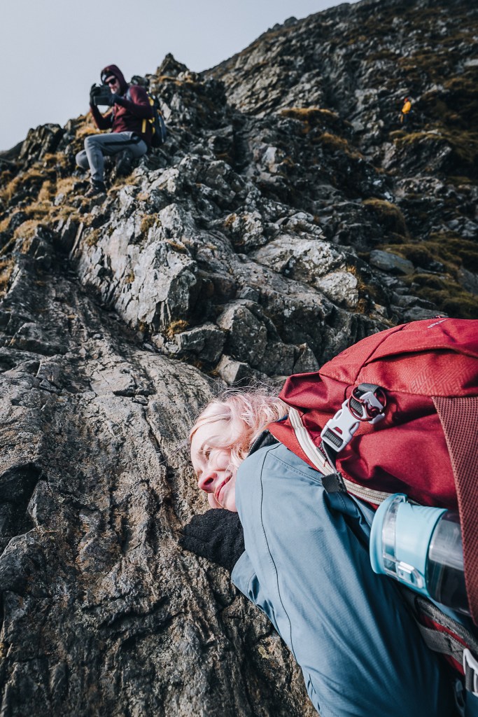
Very quickly we reached a nasty part of the scramble. Hikers know this area as the Bad Step. Being that it was November, the rock was pretty moist and slippery. The ground underneath my legs seemed to form a natural chute that I imagined firing people clean off the ridge. When I did take a step, I inevitably slipped a little.
I felt more comfortable on my hands and knees and crawled up the slippery rock towards the narrowest part of the ridge.
This is the Bad Step. A group of more confident hikers (and their much braver dog) had put down a rope and allowed us to use it to get across the greasy rock. Cheers guys, whoever/wherever you are…
Thankfully after that flat, slippery section, the spiky rocks reappear and you can get better footholds and handholds.
I think Sam’s mind was now well and truly made up. She was indeed safer with her face buried into the mountain, but we had to carry on. When you’re on these ridges, you have to keep going, cos going back is even worse. No thanks.
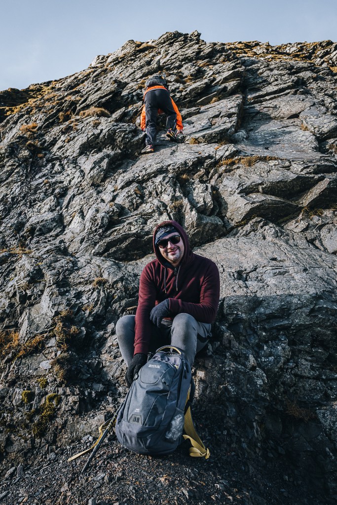
After a quick food break we carried on. We could have gone straight up the rock like this guy, but I wasn’t feeling it. I tried to scale around and go up a seemingly easier bit that turned out not to be easier. I got stuck.
Two other hikers overtook us, climbing up another crevice in the earth that I just did not fancy. And I didn’t feel comfortable climbing back down to use their route. I didn’t trust my shoes to grip the slippery rock. Eventually, I pulled my finger out, and after nearly falling I found a way up.

Soon came blessed moss. Oh how I love thee. It’s so much easier to scramble up and it’s soft and spongy and kind on the bones!
And finally…
A path! Sharp Edge was DONE.

From here, it’s a very easy walk to the top. And the delight of seeing the summit was accompanied by the joy of seeing our first snow of the year. It was soft and fluffy as well – perfect for snowball making.
Big thanks to Sam for having her camera out and capturing the moment Brendan ate the dirt and received a snowball to the head.
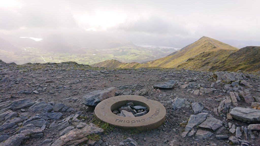
From the top of Blencathra we could see Derwentwater and Thirlmere – the latter dazzling in the low autumn sunshine. To the west we could just about make out Skiddaw before the clouds rolled in. On a clear day from up here you can have a panoramic view of the Scafell Pike, the Pennines, the Scottish mountains of Galloway , even the Isle of Man and Northern Ireland’s Mourne Mountains.
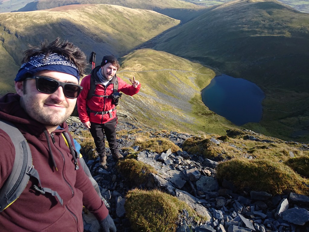
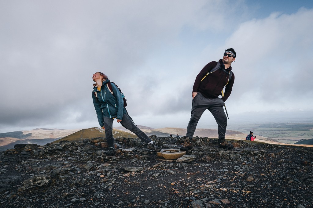
Brendan directed Sam and I into a socially distant summit photo.
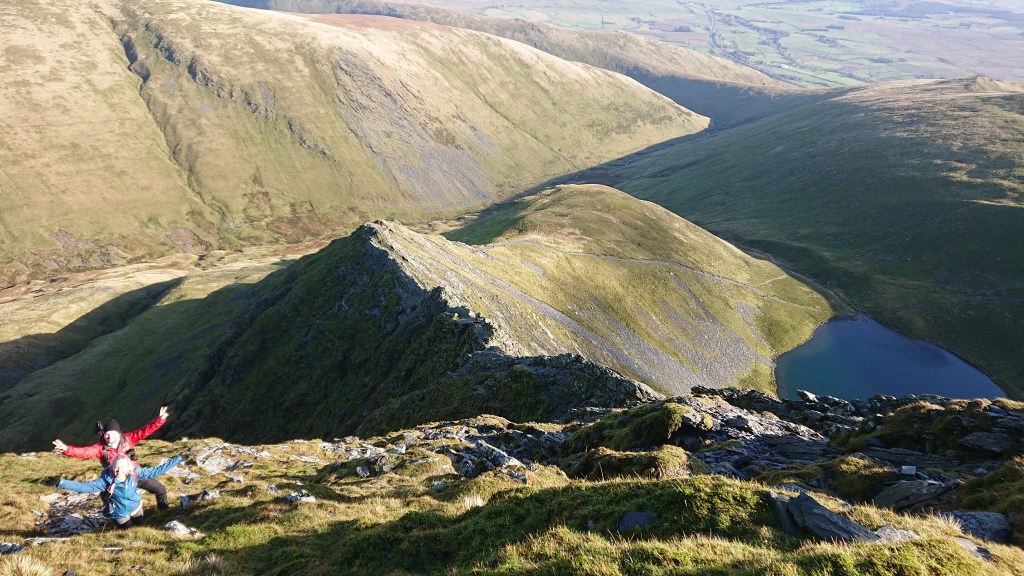
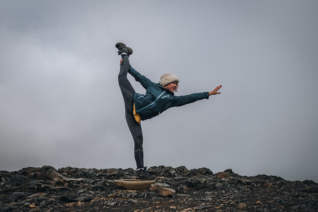
Before I sat down with a Brewdog ALD IPA and Sam got all acrobatic again.
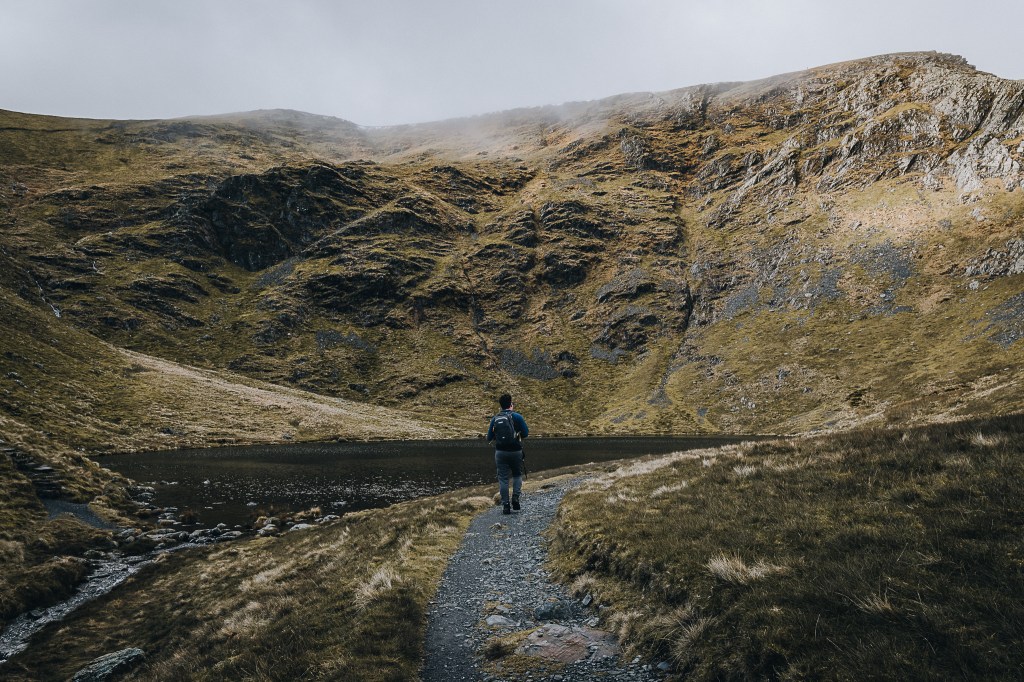
The cloud that had smothered Skiddaw were now getting closer. It was time to leave. We descended via the Scales Fell path.
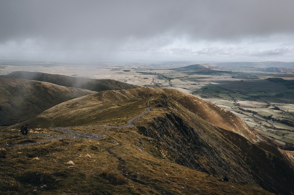
From here we got a nice view of Sharp Edge.
We could see people descending on Sharp Edge. They are much, much braver than me. IMO they’re lunatics.
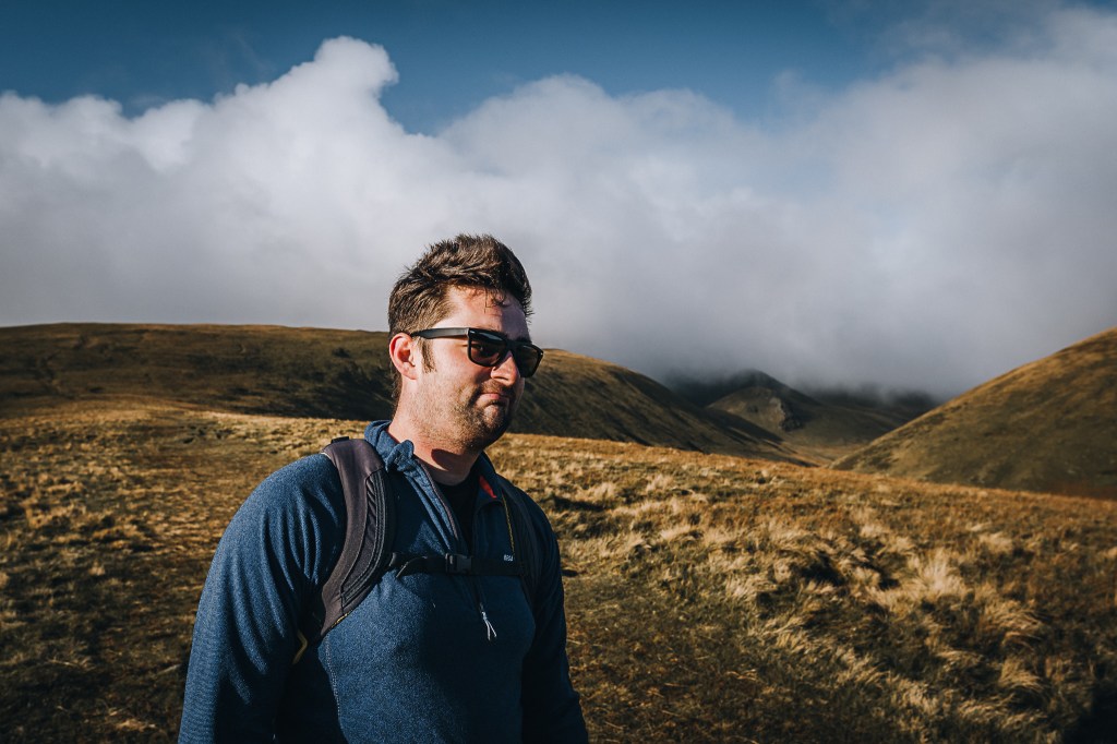
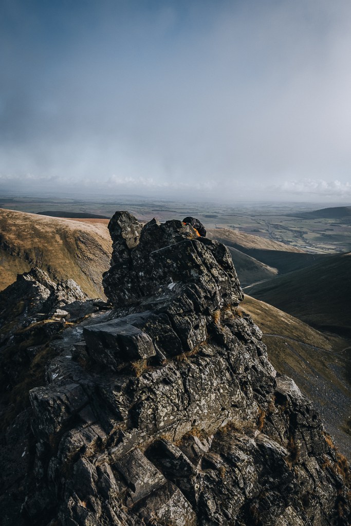
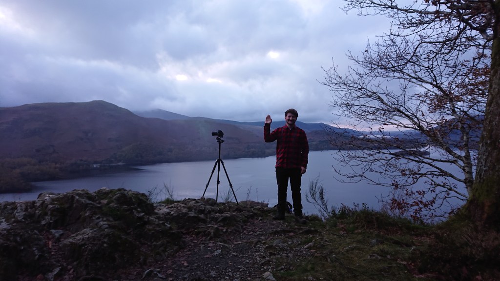
Anyway, here’s a moody photo of me looking out over the landscape.

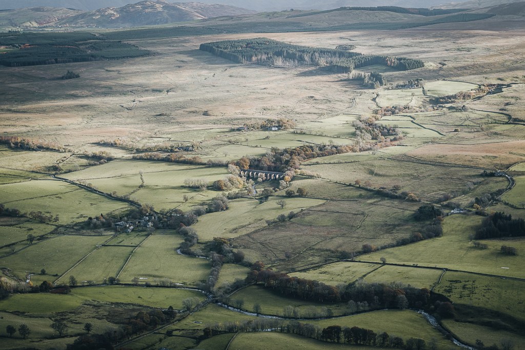
Mosedale Viaduct.
The last part of our descent brought us close to a barbed wire.
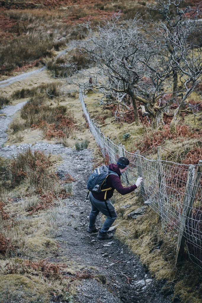
Fortunately, neither of us slipped and split open a hand or face.
Ignore the moving time btw. It took us about 3.5 hours to reach the summit. We stayed at the top for quite a while before heading down. The hike started at around 8:45am and we were at the cars just before 3pm. I didn’t check the time tbh cos I was absolutely bursting for the toilet
Sam and I drove over to the White Horse Inn for a coca cola and a wee, whilst Brendan with his camel-like bladder headed on to our next destination. Usually after such a hike I’d have just gone straight home, but seeing as this was the last day before lockdown, I figured I best make the most of it.
I drove Sam to the National Trust Great Wood car park, south of Keswick and by the shore of Derwentwater. There we found Brendan, and an abandoned BMW.
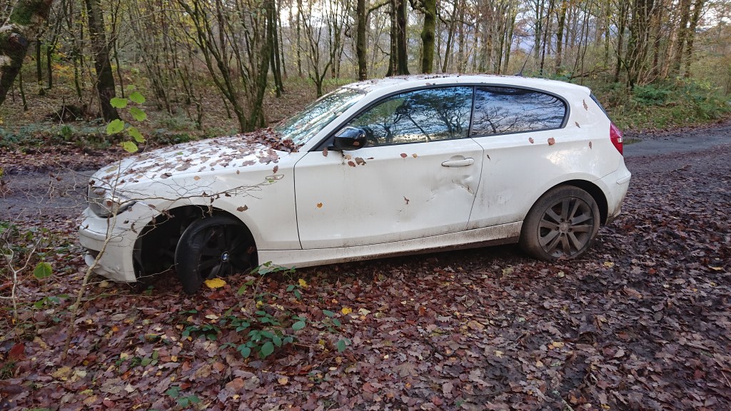
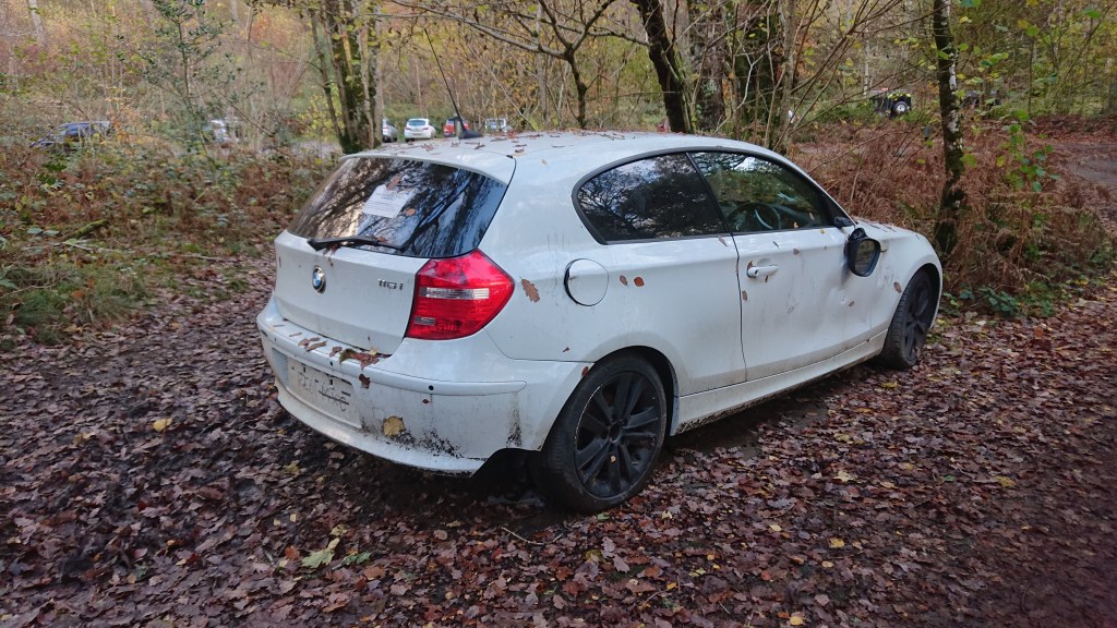
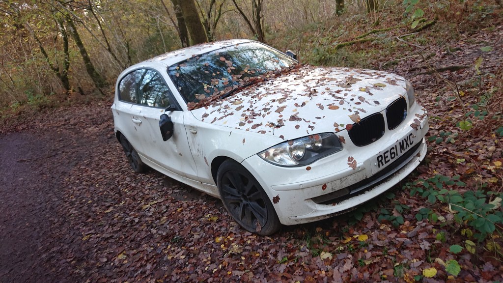
Inside its tidy and well maintained. There’s even a phone charger. If only the car could speak and tell us it’s story!
We hadn’t come here to see an abandoned car (although I did find it fascinating cos I’m a boring guy). We had come to capture some nice pics of Derwentwater in the setting sun.
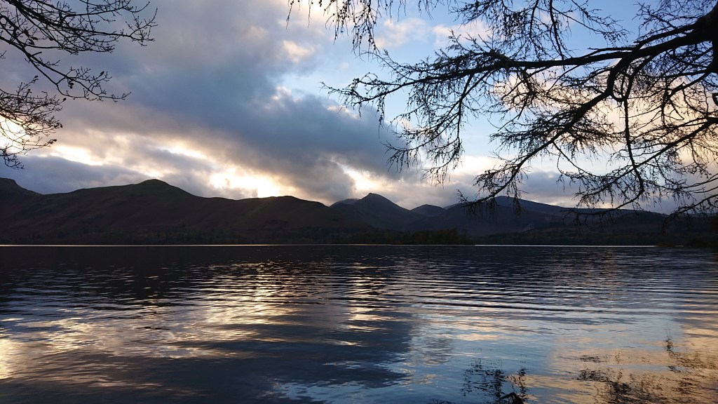
Sam and I skimmed stones as Brendan got busy with his camera.
Our final destination of the day was Surprise View.

Sadly, it was just too cloudy for a dramatic sunset. But the views were nice enough.
Ever the optimist, Brendan wanted to stick around. But Sam and I were tired. And hungry. So we bid him a fond farewell.
He chose the life of the photographer.
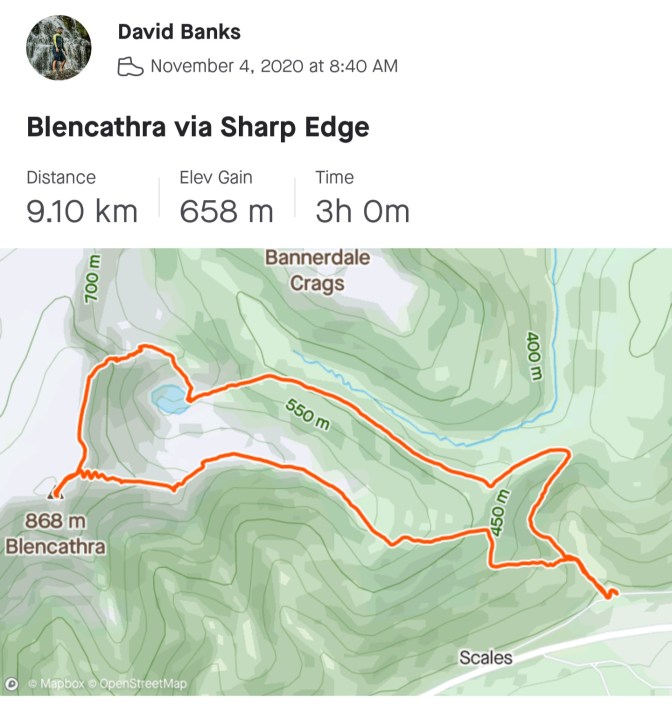
CHECK THIS OUT. Brendan has an app now that tracks his trip and turns it into a 3D animation. It. Is. Awesome. It’s called Ayvri and Brendan created the map through his ViewRanger app. You can also connect with your Strava account. Here’s our Blencathra hike:
https://my.viewranger.com/viewranger3d/track/MTY4NjgyMzc=?app=1&units=metric
DON’T FORGET TO DONATE TO SAM’S CAUSE!
Over. And. Out. Stay safe, and enjoy Lockdown 2.0!!!….
P.S. if Aldi or Brewdog wanna get in touch and use me as an Influencer, hit me up. I think I’ve got what it takes.


One thought on “Climbing Blencathra via Sharp Edge”